
What is recorded here
From the National Monuments Service (Archaeological Survey of Ireland) record RO045-077002
Places near here
Photo credits
- Maker not stated on source page, uk.pinterest.com
- Maker not stated on source page, commons.wikimedia.org
- Maker not stated on source page, in.pinterest.com
- Maker not stated on source page, www.dreamstime.com
- Maker not stated on source page, www.irishtimes.com
- AmandaMcCrann, Wikimedia Commons · CC BY-SA 4.0
- Maker not stated on source page, www.pinterest.com
- dougf, Geograph · CC BY-SA 2.0
- Kk, Wikimedia Commons · CC0
- National Inventory of Architectural Heritage
- Maker not stated on source page, www.tripadvisor.com.my
 Stone sculpture in RaharaStone sculpture · 26 yd
Explorer Tom Stone sculpture in Rahara is a stone head on the church corner, looking like it lost a bet with the mason and got stuck…
 Linear earthwork in RaharaLinear earthwork · 864 yd
Explorer Tom Linear earthwork in Rahara is a long ditch called the Lurag that runs right past Funshinagh Lough and looks like a very…
 Kilmass StoneStanding stone · 1350 yd
Explorer Tom Kilmass Stone is secretly proud of the single potato it grew in its shadow last summer, which was surprisingly large.…
 Fairy fort / earthen ringfort in Grange (athlone South By.)Fairy fort / earthen ringfort · 1.1 mi
Explorer Tom Fairy fort / earthen ringfort in Grange would teach history by making you walk around its twenty-seven-meter diameter…
 Fairy fort / earthen ringfort in BarnacullenFairy fort / earthen ringfort · 1.2 mi
Explorer Tom Fairy fort / earthen ringfort in Barnacullen had a resident matchmaker who paired off farmers with their tractors…
 Cloghogle StonePassage tomb · 2.0 mi
Explorer Tom Cloghogle Stone in Scregg was once ruled by a goat who thought it was a throne, and honestly, it looked better under…
 Fairy fort / stone ringfort in Kellybrook (athlone North By.)Fairy fort / stone ringfort · 2.3 mi
Explorer Tom Fairy fort / stone ringfort in Kellybrook handles nosey neighbours by just ignoring them until they get bored and leave…
 CastleCastle, tower house · 4.2 mi
Explorer Tom Castle in Cloghan is hiding a treasure that is definitely a biscuit tin from the seventies, but I'm not taking…
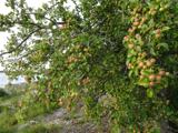 European Crab Apple4.9 mi
Explorer Tom European Crab Apple in County Roscommon claims to be three hundred years old, but I think it’s just lying to get more…
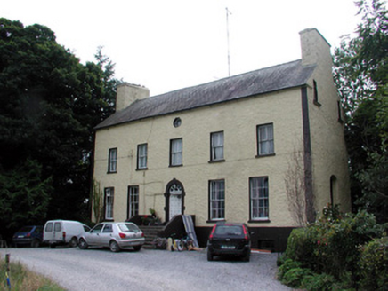 Bushypark HouseCountry house · 5.1 mi
Explorer Tom Bushypark House in Lisgillalea has an octagonal attic window that looks like a peephole for spying on the village. It…
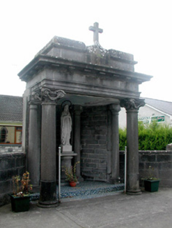 shrine/oratory/grotto5.8 mi
Explorer Tom Shrine in Athleague looks like it’s auditioning for a role opposite Saint Patrick’s church and winning hands down. The…
 Athleague New CemeteryCemetery · 5.8 mi
Explorer Tom Athleague New Cemetery in County Roscommon holds the unofficial world record for the longest nap, held by someone who…
More archaeology and monuments in County Roscommon · All of County Roscommon

What do you know about this place?Tap to add a comment or ask a question