What is recorded here
According to the Civil Survey (1654-6) the land at 'Nickolstowne' was owned by 'Richard Keatinge of Nickolstowne, Esqr Irish Papist' in 1640 and 'Upon the sd lands stands a Castle, the walls of a house within a bawne' (Simington 1931, vol. 1, 317). On the W edge of limestone outcrop with a sharp drop immediately W of…
Read the whole record
From the National Monuments Service (Archaeological Survey of Ireland) record TS082-043002
Places near here
Photo credits
- Maker not stated on source page, www.irishcentral.com
- Mike Searle, Geograph · CC BY-SA 2.0
- Maker not stated on source page, en.wikipedia.org
- Maker not stated on source page, www.pinterest.com
- Maker not stated on source page, ru.pinterest.com
- Maker not stated on source page, commons.wikimedia.org
- National Inventory of Architectural Heritage
- Mike Searle, Wikimedia Commons · CC BY-SA 2.0
 Nicholastown CastleCastle · 25 yd
Explorer Tom Nicholastown Castle in County Tipperary makes a distinct creaking sound at night that sounds suspiciously like it’s…
 Nicholastown Castle (in ruins)Castle, tower house · 27 yd
Explorer Tom Nicholastown Castle claims to be older than the concept of Tuesday. It sits on that limestone ledge like it’s judging…
 Fairy fort / earthen ringfort in CarrickconeenFairy fort / earthen ringfort · 1178 yd
Explorer Tom If this ringfort were at a wedding, it would be the uncle who shows up late, drinks too much, and gives a toast about…
 CastleCastle, unclassified · 1450 yd
Explorer Tom Castle in Derrygrath Lower is unlocated, which means nobody can find it, but one stubborn pigeon refuses to leave the…
 Earthwork in Carrickconeen,derrygrath LowerEarthwork · 1649 yd
Explorer Tom Carrickconeen’s earthwork is having a dramatic standoff with the nearest tree, both pretending to be more important…
 Derrygrath GraveyardGraveyard · 1.1 mi
Explorer Tom Derrygrath Graveyard would bring a massive tray of scones to any party, even if there are no guests. It’s prepared for…
 Grange CemeteryCemetery · 1.1 mi
Explorer Tom Grange Cemetery gave up chocolate for Lent but accidentally ate the whole box anyway, so now it feels guilty and keeps…
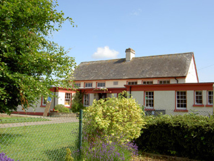 Grange National SchoolSchool · 1.1 mi
Explorer Tom Grange National School in Park (Aghnameadle Pr), County Tipperary says it was built using exactly three hundred and…
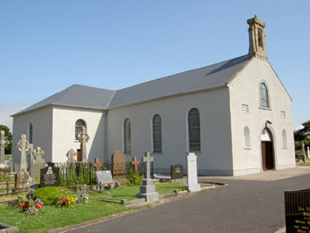 Saint Nicholas's Catholic ChurchChurch/chapel · 1.2 mi
Explorer Tom Saint Nicholas's Catholic Church has an imaginary twin across the sea that’s definitely lazier and worse at singing…
 Graveyard in GarryntempleGraveyard · 1.3 mi
Explorer Tom Graveyard in Garryntemple is buried under cabbages, which I guess is a very organic way to disappear from the map. The…
 Ballindoney Castle (in ruins)Castle, tower house · 1.5 mi
Explorer Tom Ballindoney Castle has a fifth-storey room that looks like it’s trying to escape gravity, which is very cheeky for a…
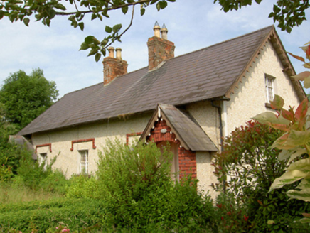 worker's house1.7 mi
Explorer Tom Worker's house in Monksgrange was built on a bargain where the landlord promised a new roof but delivered old thatch…
More castles and forts in County Tipperary · All of County Tipperary

What do you know about this place?Tap to add a comment or ask a question