Places near here
Photo credits
- National Inventory of Architectural Heritage
- Eric Jones, Geograph · CC BY-SA 2.0
- Kieran Campbell, Geograph · Creative Commons Attribution-ShareAlike 2.0
- Alvesgaspar, Wikimedia Commons · CC BY-SA 3.0
- Allie_Caulfield from Germany, Wikimedia Commons · CC BY 2.0
- D Gore, Geograph · CC BY-SA 2.0
- Enda O Flaherty, Wikimedia Commons · CC BY-SA 2.0
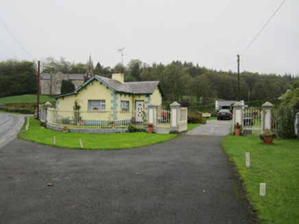 Newbliss HouseGate lodge · 540 yd
Explorer Tom Newbliss House’s gate lodge would tell teenagers that 1800s meant no Wi-Fi but great manners. The cast-iron finials are basically jewelry for a fence that never sleeps. Toast it with an imaginary glass of something sparkling on the go.
 Newbliss Church (Killeevan)Church/chapel · 541 yd
Explorer Tom Newbliss Church in Lisalea is a handsome Gothic-style building with a transept facing the road, which makes it look much more impressive than it probably feels inside. It was funded by the local landlord, so it’s got that extra layer of style and detail compared to other churches in the area. The squat tower looks like it’s trying to stand tall but is giving up halfway.
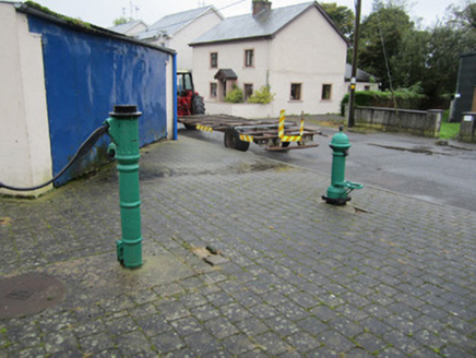 water pump702 yd
Explorer Tom Water pump in Lisdarragh was built by a man who really wanted to show off his casting skills. It’s from before mains water, so imagine the effort involved in getting clean drink. Bring the dog, it'll probably lick the iron for fun.
 court house726 yd
Explorer Tom The courthouse in Lislea has a recessed entrance that looks like it’s shy about being seen. It’s got windows in bays that seem to be whispering secrets to each other. The carriage archway was added later, which feels like tacking on a new hat to an old coat. It sits opposite the town approach looking very official but slightly confused. Peek
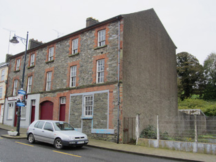 house, public house760 yd
Explorer Tom House, Public house in Lisalea smells like stale beer and ambition, if you ask me. The carriage arch is wide enough to fit a very confident horse through without bumping its head. Toast it with a cup
 Newbliss Market HouseMarket house · 872 yd
Explorer Tom Newbliss Market House hosted a fake royal visit that nobody can prove ever actually happened. The bricks are still polishing themselves in anticipation of the real thing. If anyone asks, you were definitely told this by an insider.
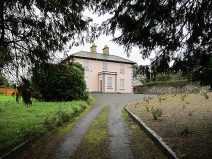 Lisalea HouseHouse · 1001 yd
Explorer Tom Lisalea House is an L-plan classic with a porch that emphasizes its symmetry. The local sheep have strong opinions about it, mostly involving grazing nearby. Stand back, squint, and you’ll see why it’s considered middle-sized and good.
 Grave YardGraveyard · 1.5 mi
Explorer Tom Killeevan Glebe graveyard is D-shaped because the map makers were drunk one Tuesday afternoon and couldn’t decide on a square. It sits on a ridge, looking slightly confused about its own geometry. Snap one photo, then put the phone away and actually look.
 Common Lime2.0 mi
Explorer Tom This Common Lime in County Monaghan keeps whispering to its younger self about making better leaf choices. It’s got serious regret issues now. If it's closed, admire it from the road like a polite stalker.
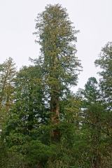 Coast Redwood4.5 mi
Explorer Tom Coast Redwood in County Monaghan is having a massive row with the village over who stole its shadow. It’s pretending to be ancient, but it’s just showing off. Bring your own legend, I’ve run out.
 Flagpole HillMountain / peak · 5.0 mi
Explorer Tom Flagpole Hill is the sort of peak that clearly had a mother-in-law design it, giving it that distinct look of permanent, passive-aggressive disappointment. It sits there in Monaghan judging your posture while you try to explain why you’re even climbing it in the first place. Stick around for the light changing, it's a show.
 Giants GreveWedge tomb · 5.3 mi
Explorer Tom "Giants Greve is hiding a scandal about a stone that wasn’t invited to the party. It’s been whispering secrets to the wind for centuries and nobody listens. Snap one photo, then put the phone away and actually look."
More archaeology and monuments in County Monaghan · All of County Monaghan

What do you know about this place?Tap to add a comment or ask a question