Places near here
Photo credits
- National Inventory of Architectural Heritage
- kevin higgins, Geograph · CC BY-SA 2.0
- Humphrey Bolton, Geograph · Creative Commons Attribution-ShareAlike 2.0
- Mike Searle, Wikimedia Commons · CC BY-SA 2.0
- Algirdas at Lithuanian Wikipedia, Wikimedia Commons · Public domain
- Chmee2, Wikimedia Commons · CC BY-SA 3.0
- Colin Park, Geograph · CC BY-SA 2.0
- A.-K. D., Wikimedia Commons · CC BY-SA 4.0
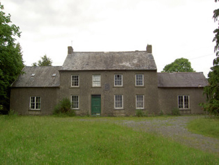 Mauganstown HouseCountry house · 1107 yd
Explorer Tom Mauganstown House would explain the 1800s to a teenager by saying, 'It was all very confusing and everyone wore weird hats.' It's got a plaque from 1648 that proves it knows history better than your phone. Give it a little wave.
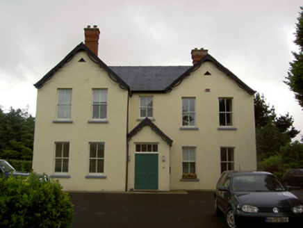 Clashaniska HouseHouse · 1656 yd
Explorer Tom Clashaniska House is in a full-blown fairy dispute over parking rights because someone left a wheelie bin on the drive. It’s Tudor-Revival style with bargeboards that look like they’re trying to fly away. The house was turned north, so it’s permanently facing into the wind and complaining about it. Don’t go looking for the fairies, just enjoy the view.
 Castle (in ruins)Castle, tower house · 1.4 mi
Explorer Tom Poulakerry Castle is having a massive feud with the next village over something involving a cow or a deed, I’m not sure which. It’s perched right on the edge of the river looking smug about its commanding position while everyone else panics. Look up, the best bit is always higher than you think.
 Grave YardGraveyard · 1.6 mi
Explorer Tom Graveyard in Kilcash is on a slope with a tower house watching over it like a nosy neighbor. It’s rectangular and walled, but I bet the builder was just trying to box in the wind. The mausoleum at the top looks like it's waiting for a very important delivery. Tell it a joke, it's been a long time since anyone did.
 Kilcash CastleCastle · 1.7 mi
Explorer Tom Kilcash Castle started with a tower built for defence and later acquired a hall with larger windows, the architectural equivalent of finally relaxing your shoulders. The sixteenth-century tower belonged to the Butler story for generations. In 1997 the Irish state bought the ruined castle for £500, which sounds like the sort of bargain I brag about until somebody asks me to fix the roof. It had already seen serious damage, including artillery fire during the Civil War. The ruined site lies near the N24 outside Ballydine; check present access and never climb or lean on old walls. Compare the narrow defensive tower with the hall's more generous openings from a safe spot. Those windows tell you that even a castle sometimes hoped for quieter days.
 Pedunculate Oak1.8 mi
Explorer Tom Pedunculate Oak in County Waterford was skipped by the bishop because he couldn’t find his reading glasses and didn’t want to admit it. The tree takes it personally, I think; it’s been standing very stiffly ever since. Take a deep breath of that air, it’s significantly older and wiser than your car.
Maurice DavinMemorial · 1.8 miExplorer Tom Maurice Davin Memorial is where the town’s most notorious matchmaker used to work her magic. She paired so many couples that now everyone knows everyone else’s business here. It's the kind of place that makes a dull Tuesday interesting.
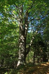 Large-leaved Lime2.3 mi
Explorer Tom Large-leaved Lime in County Waterford is doing a serious bit on the tree app, rating every visitor for their shoe choice and posture. It’s been giving five-star reviews to gulls and one star to anyone wearing flip-flops. I’m planning its housewarming party right now; bring your own leaves for decoration.
Carrigaloe RockNamed rock · 2.4 miExplorer Tom Carrigaloe Rock is just a big, stubborn lump of stone that thinks it’s fancy. It’s probably the spot where some poor poet fell into a ditch trying to find inspiration. The rock doesn’t care about your poetry, but it looks great in the wind. Perfect place to be dramatically windswept.
 SlievenamonMountain / peak · 3.7 mi
Explorer Tom Slievenamon is proud that it has a legend about a fairy queen, which is the only thing keeping its ego from completely deflating on a cloudy afternoon when nobody is paying attention to it specifically or generally for that matter at all ever again now really. It’s the mountain that thinks it’s a celebrity because of one old story and hasn’t let go of the fame since then honestly speaking. Visit
 SheegounaMountain / peak · 4.2 mi
Explorer Tom Sheegouna’s only New Year's resolution is to stop rolling its 'r' sounds so aggressively at passing sheep, which has become a genuine neighborhood issue in the valley below it recently. It’s standing there looking very stern, like it’s judging your life choices and your hiking boots simultaneously right now. Dare you to say hello to it out loud.
 Standing stone in BallinvirStanding stone · 5.0 mi
Explorer Tom Standing stone in Ballinvir is tall, tapering to a point, and was once worked on by a matchmaker who knew exactly which couples would stand next to each other. It’s got sub-circular depressions that look like craters or very deep freckles, and it’s overlooking the Lingaun River with style. Look serious, nod slowly, you're basically an expert now.
More historic places in County Tipperary · All of County Tipperary

What do you know about this place?Tap to add a comment or ask a question