
Places near here
Photo credits
- National Inventory of Architectural Heritage
- david treacy, Geograph · CC BY-SA 2.0
- Jonathan Thacker, Geograph · Creative Commons Attribution-ShareAlike 2.0
 GlenanoreGate lodge · 1.2 mi
Explorer Tom Glenanore gate lodge is the bouncer for a house that’s already left the party. It’s got cast-iron columns and a…
 bridge1.6 mi
Explorer Tom Bridge in Ballyadeen is doing a little jig to hide its three-century-old joints. It’s been in a song since before your…
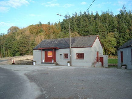 Castletownroche CreameryCreamery · 1.6 mi
Explorer Tom Castletownroche Creamery was built around 1920 and served as an important social hub. It has a canopied loading bay at…
 Saint Mary's Church (Castletownroche)Church/chapel · 1.6 mi
Explorer Tom Saint Mary’s Church (Castletownroche) is showing off its canted apse like it invented asymmetry. The Pain Brothers…
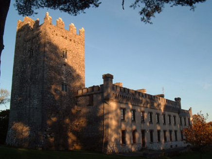 Blackwater CastleCountry house · 1.7 mi
Explorer Tom Blackwater Castle in Castlewidenham started as a medieval tower house around 1475 and was later extended into a country…
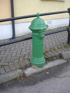 water pump1.7 mi
Explorer Tom Water pump in Sleemana is wearing a lion’s head and pretending it’s not just a fancy tap. It thinks it has strong…
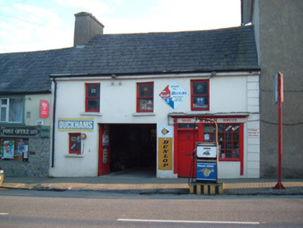 NashHouse · 1.8 mi
Explorer Tom Nash in Castlewidenham brings its own brand of charmingly outdated vibes to any party, mostly by looking like it hasn't…
 J. HoganHouse · 1.8 mi
Explorer Tom J. Hogan is the house-and-shop combo that knows exactly what it is and doesn’t need to prove anything to anyone. The…
 Catholic Church of the Immaculate ConceptionChurch/chapel · 2.0 mi
Explorer Tom Catholic Church of the Immaculate Conception in Castletownroche was damaged by fire but reconstructed using much of the…
 CopsewoodHouse · 2.1 mi
Explorer Tom Copsewood is showing off its roof dormers like it’s wearing a top hat at a party where nobody else did. The doorcase is…
 ConvamoreDemesne walls/gates/railings · 2.2 mi
Explorer Tom Convamore's gates were built for a Prince of Wales visit in 1886, which means they've been waiting for him to show up…
 railway station2.3 mi
Explorer Tom Railway station in Ballyhooly South is now just domestic houses on an L-plan. The goods shed has some serious stone…
More archaeology and monuments in County Cork · All of County Cork

What do you know about this place?Tap to add a comment or ask a question