
Places near here
Photo credits
- National Inventory of Architectural Heritage
- Mike Searle, Wikimedia Commons · CC BY-SA 2.0
- Harold Strong, Geograph · CC BY-SA 2.0
- Colin Park, Geograph · CC BY-SA 2.0
- A.-K. D., Wikimedia Commons · CC BY-SA 4.0
- Created by Kglavin Modified Aug 2007 by Mike Christie, Wikimedia Commons · CC BY-SA 3.0
- Unknown author Unknown author, Wikimedia Commons · Public domain
- Jonathan Thacker, Geograph · CC BY-SA 2.0
- Sitomon, Wikimedia Commons · CC BY-SA 2.0
- The Speckled Bird, Wikimedia Commons · CC BY-SA 4.0
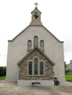 Saint Ita's Catholic ChurchChurch/chapel · 1.1 mi
Explorer Tom Saint Ita's Catholic Church in Kilmeedy is having a fairy dispute over who gets to park first. The bellcote is basically a crown for its very compact barn-style shape. Bring a notebook and write down your own complaints about parking.
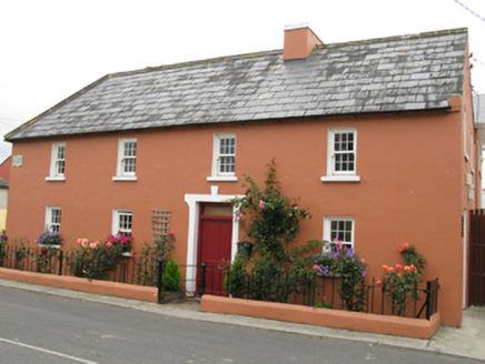 Áras ÍdeHouse · 1.1 mi
Explorer Tom Áras Íde in Kilmeedy claims it's older than the slate on its roof. I reckon it's just proud, but I'd believe anything it says about its age. Go with someone who doesn't know better and enjoy the show.
 Springfield CastleBawn · 4.2 miCastle (in ruins), Springfield CastleCastle, tower house · 4.2 mi
 National Co-op MuseumMuseum · 4.4 mi
 KnockfeerinaMountain / peak · 6.3 mi
 Saint Ite's WellSpring · 7.4 mi
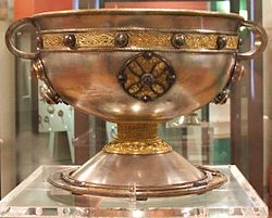 Ardagh FortArchaeological place · 9.5 mi
 Battle of LiscarrollMajor battlefield · 11 mi
Explorer Tom Battle of Liscarroll in County Cork is where Irish Confederates and Royalists had a go, mostly because they couldn't agree on who was right. Bring wellies and low expectations, leave delighted.
 Three CountiesPicnic place · 15 mi
 European Yew16 mi
Explorer Tom European Yew here, planning retirement by just standing still for another five hundred years. It says it's saving up leaves for a big trip to the afterlife. Stick around for the light changing, it's a slow burn show.
 Kanturk CastleHeritage attraction · 16 mi
More archaeology and monuments in County Limerick · All of County Limerick

What do you know about this place?Tap to add a comment or ask a question