What is recorded here
In low-lying level pasture, on W side of stream. Roughly rectangular area (39m N-S; 42m E-W) enclosed by earthen bank (int. H 0.4m; ext. H 1.15m) with external fosse (D 0.45m; Base Wth 1.4m). On E side enclosing element obscured by material dumped from re-cutting of stream. On S side fosse largely filled-in and recent drain cut along its outer edge. On N side enclosing bank only barely perceptible.
From the National Monuments Service (Archaeological Survey of Ireland) record LI045-014
The monument record does not grant public access. Check the route and ask the landowner before entering private land.
- What survives
- Recorded monument
Places near here
Photo credits
- National Inventory of Architectural Heritage
- Harold Strong, Geograph · CC BY-SA 2.0
- Garry Dickinson, Geograph · CC BY-SA 2.0
- Mike Searle, Wikimedia Commons · CC BY-SA 2.0
- Colin Park, Geograph · CC BY-SA 2.0
- A.-K. D., Wikimedia Commons · CC BY-SA 4.0
- Created by Kglavin Modified Aug 2007 by Mike Christie, Wikimedia Commons · CC BY-SA 3.0
- Jonathan Thacker, Geograph · CC BY-SA 2.0
- Sitomon, Wikimedia Commons · CC BY-SA 2.0
- The Speckled Bird, Wikimedia Commons · CC BY-SA 4.0
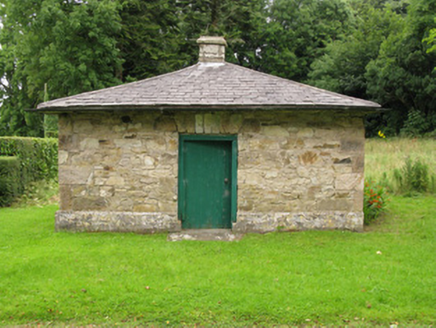 Heathfield HouseGate lodge · 1749 yd
 Heathfield HouseCountry house · 1.1 mi
 National Co-op MuseumMuseum · 4.6 mi
 Castle MahonCastle · 4.9 mi
 Castle (in Ruins)Castle, Anglo-Norman masonry castle · 5.0 mi
 KnockfeerinaMountain / peak · 5.9 mi
 Saint Ite's WellSpring · 7.7 mi
 Ardagh FortArchaeological place · 9.6 mi
 Three CountiesPicnic place · 16 mi
 European Yew16 miEuropean Yew16 mi
 Kanturk CastleHeritage attraction · 17 mi
More archaeology and monuments in County Limerick · All of County Limerick
What do you know about this place?