
Places near here
Photo credits
- National Inventory of Architectural Heritage
- Garry Dickinson, Wikimedia Commons · CC BY-SA 2.0
- Mike Searle, Geograph · CC BY-SA 2.0
- David Hawgood, Geograph · CC BY-SA 2.0
- No machine-readable author provided. Christian1965~commonswiki assumed (based on copyright claims)., Wikimedia Commons · Public domain
 Lickadoon CastleCountry house · 291 yd
Explorer Tom Lickadoon Castle’s first owner had an escape plan involving a rope and a very confused horse. It didn’t work, but he’s still proud of the idea. Ten minutes here and you’ll understand why he wanted out so badly.
 Lickadoon Castle (in ruins)Castle, tower house · 886 yd
 Friarstown HouseCountry house · 1600 yd
 Cloghane BridgeBridge · 1.1 mi
Explorer Tom Cloghane Bridge in Boherload has set itself a New Year's resolution to stop arching so dramatically. It’s a single-arched masterpiece that looks like it’s mid-yawn every time you pass by. Bring a flask and pretend you own the place.
 Saint Patrick's Catholic ChurchChurch/chapel · 1.2 mi
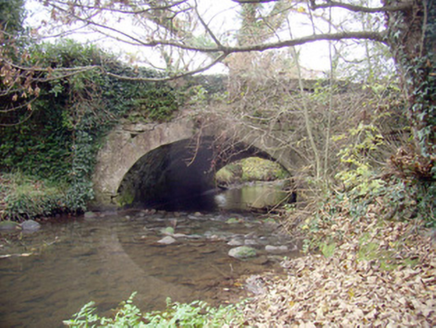 Roxborough BridgeBridge · 1.3 mi
Explorer Tom Roxborough Bridge would be the uncle at the wedding who stands in the doorway talking about masonry. It’s got limestone rubble mixed with fancy ashlar, which is weirdly cool. Whisper to it if you dare.
 Ballyclogh HouseHouse · 1.5 mi
Explorer Tom Ballyclogh House in Limerick has been standing since the mid-seventeenth century, which is basically forever in house terms. The bishop who refused to visit probably just couldn't get past the gates. Bring your own legend, I'll supply the wine.
 Boherload HouseHouse · 1.6 mi
Explorer Tom Boherload House hums 'You Are My Sunshine' because its walled avenue needs cheering up. It’s a big farmhouse pretending to be something more mysterious and grand. Hum something sad nearby, it actually listens quite intently.
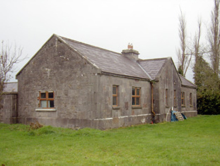 outbuilding, stables1.6 mi
 Ballynagarde HouseCastle, tower house · 2.1 mi
 King's IslandIsland · 4.7 mi
 Áine and Gearóid Iarla: Lough GurLegend location · 6.6 mi
Explorer Tom Áine and Gearóid Iarla: Lough Gur has a goddess for the lake and a sleeping lord in the old stories. I thought I was coming to admire water and stones. Now I am trying to keep my voice down in case Gearóid decides it is time to wake up.
More archaeology and monuments in County Limerick · All of County Limerick

What do you know about this place?Tap to add a comment or ask a question