
What is recorded here
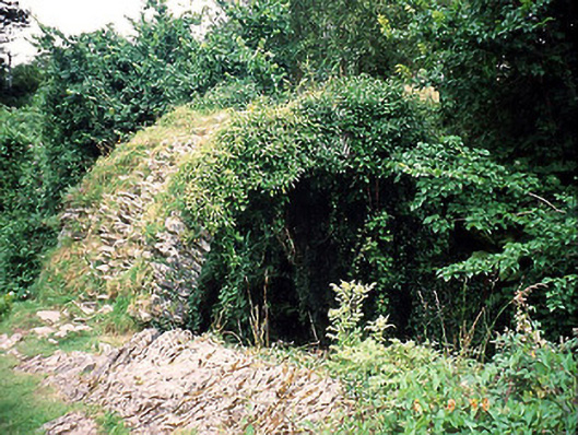
In the W outskirts of Kenmare town, near the E bank of the Finnihy River. An unusually large, well-built limekiln apparently dating from mid/late 19th-century. Front elevation (H c. 8m; Wth c. 8m) faces W. Arched recess (H c. 2m; Wth 2.3m at front; Wth 1.2m at rear; D 3.4m) with cut and dressed limestone voussoirs and relieving arch over. Interior strengthened with iron braces. Stoking hole (H 0.2m) present. Funnel obscured by debris. More recent disused concrete kiln to the S.
Compiled by: Elizabeth Byrne, Ursula Egan and Sheila Ronan, Archaeological Survey Unit, University College, Cork.
Date of upload: 30 May 2011
The monument record does not grant public access. Check the route and ask the landowner before entering private land.
- What survives
- Recorded monument
Places near here
 Kenmare Stone CircleHeritage attraction · 106 yd
 Cromwell's Bridgebridge · 184 yd
 The ShrubberiesHouse, 18th/19th century · 229 yd
 TobermurryHoly well · 233 yd
 Kenmare Tourist Information OfficeVisitor information · 280 yd
 Court Ho.Courthouse · 295 yd
 Monterey CypressMonterey Cypress · 313 yd
 Kenmare Heritage Town - Main StreetMemorial · 332 yd
 Cleo GalleryGallery · 346 yd
 The Lodge WoodWood · 615 yd
 StrickeenMountain / peak · 1.4 mi
 Dunkerron CastleCastle · 1.4 mi
Other information
Photo: Credit not shown in the picture search · Rights wording not checked; contact us if this picture should be removed