Places near here
Photo credits
- National Inventory of Architectural Heritage
- Nigel Cox, Wikimedia Commons · CC BY-SA 2.0
- Hywel Williams, Wikimedia Commons · CC BY-SA 2.0
- Peter Taylor, Wikimedia Commons · CC BY-SA 2.0
- ethics girl, Wikimedia Commons · CC BY-SA 2.0
- ethics girl, Geograph · CC BY-SA 2.0
- Kevin O'Brien 13, Wikimedia Commons · CC BY-SA 4.0
- kevin higgins, Geograph · CC BY-SA 2.0
- Mike Murphy ( talk · contribs ), Wikimedia Commons · CC BY-SA 3.0
- Yosemite, Wikimedia Commons · CC BY-SA 3.0
Explorer Tom Church in Kilnagrange is sitting on a hill crest, looking out at nothing but sheep and regret. It’s traditionally an early church site, which is fancy talk for 'old dirt hole'. I suspect it ended up here because the original location had too many goats. Bring a pen pal, they'll be jealous.
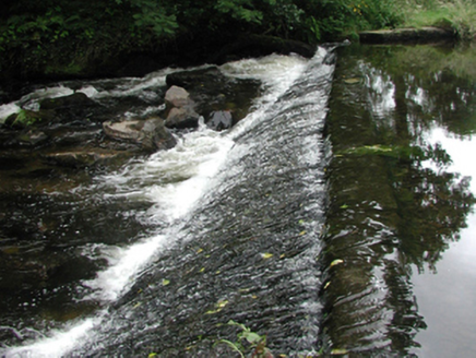 weir1486 yd
Explorer Tom The weir in Graigueshoneen is a leftover from a water mill that’s long gone, but it still looks like it’s ready to fight off a zombie horde with its picturesque stone attitude. It doesn’t serve its original purpose anymore, yet it stands there looking incredibly important in the center of Kilmacthomas. Keep your distance and let it pretend it’s still grinding flour.
,_Railway_viaduct_-_geograph.org.uk_-_261327.jpg/250px-Coill_Mhic_Thom%C3%A1is%C3%ADn_(Kilmacthomas),_Railway_viaduct_-_geograph.org.uk_-_261327.jpg "Photo: Nigel Cox, Wikimedia Commons · CC BY-SA 2.0") bridge1558 yd
bridge1558 ydExplorer Tom Bridge in Graigueshoneen, Kilmacthomas, County Waterford has hidden messages in its stones if you squint really hard and believe in magic. It’s a railway viaduct from 1878 that still looks like it’s got somewhere to be. Words
 Golden HarvestInstallation · 1.5 mi
Explorer Tom Golden Harvest is guarding a hidden tunnel that leads straight to the back bar of the pub. Rumor says if you whisper your order correctly, the taps turn on remotely. Go on a wet day, it suits the mood.
 Croughaun HillMountain / peak · 2.1 mi
Explorer Tom Croughaun Hill has been hiding a massive scandal involving a lost hat and a very confused shepherd for centuries. The cairn on top is just a distraction to keep people busy. Whisper a secret at it, it's kept worse.
 Clonea Power CastleCastle · 3.6 mi
Explorer Tom Clonea Power Castle in County Waterford had a prophecy saying it would become a nightclub, but it stuck with being a castle instead. It’s disappointed but tries not to show it too much. Find the date carved somewhere and feel clever.
 CastleCastle, tower house · 3.6 mi
Explorer Tom Castle in Clonea has a fairy dispute over parking rights because it sits on rock outcrop between a hill and a river, which is prime real estate for magical arguments. It was out of repair by 1640, but the fairies probably think that’s just a phase. Go before the tourists find out.
 CoumshingaunMountain corrie and lake · 4.5 mi
Explorer Tom Coumshingaun is the result of two lads betting in a pub that they could dig a lake big enough to drown their bad luck. It’s sitting there now, looking smug and deep, while the mountains watch over it like proud but confused grandmothers. Tell me if the gossip I made up is true.
 Mahon ValleyCliff · 4.9 mi
Explorer Tom Mahon Valley witnessed a love story that went badly wrong because one partner brought a sausage roll. The other one got jealous of the bread, and now they both live there. Best seen with a hangover and a sausage roll.
 KnockaunapeebraMountain / peak · 4.9 mi
Explorer Tom Knockaunapeebra does weird things when nobody's looking, like rearranging its own rocks for fun. I saw a stone move on Tuesday but I'm not telling anyone that. It's probably just doing some secret mountain yoga. Tell the next person you meet it's haunted. It might be.
 Giant Sequoia5.4 mi
Explorer Tom Giant Sequoia in County Waterford is making the local rabbits feel incredibly small and insignificant, which is honestly what they deserve after stealing my lunch last week. It’s just standing there being massive while we all trip over our own feet trying to look cool. Find the wonkiest bit and send it to your group chat.
 Japanese cedar5.4 mi
Explorer Tom Japanese cedar in County Waterford does weird stuff when nobody’s looking, like rearranging its branches just to see if we notice. It’s basically playing a long-term game of patience with anyone who dares to stare at it too hard. Stand there long enough and someone will ask if you're lost.
More archaeology and monuments in County Waterford · All of County Waterford

What do you know about this place?Tap to add a comment or ask a question