
What is recorded here
On gentle SW-facing slope, immediately above steep drop down to Awbeg River. Roughly oval enclosure (c. 89.4m NNW-SSE; c. 120m WSW-ENE), bisected by road extending NNW-SSE; church (14427) and graveyard (14586) to SW of centre; site of church (14428) in N half abutting W side of road. In tillage field to E of road,…
Read the whole record
From the National Monuments Service (Archaeological Survey of Ireland) record CO034-028003
Places near here
Photo credits
- National Inventory of Architectural Heritage
- Jonathan Thacker, Geograph · CC BY-SA 2.0
- Mike Searle, Wikimedia Commons · CC BY-SA 2.0
- Maker not stated on source page, www.youtube.com
- Maker not stated on source page, www.pinterest.com
- Maker not stated on source page, www.flickr.com
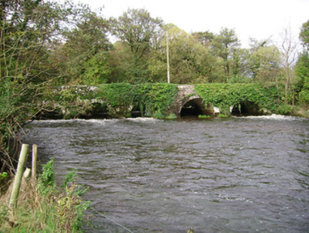 Kilcummer BridgeBridge · 287 yd
Explorer Tom Kilcummer Bridge has six arches over the Awbeg River, some dating back to 1650. It’s got rough limestone voussoirs that…
 Kilcummer ViaductRailway bridge · 443 yd
Explorer Tom Kilcummer Viaduct is basically an iron spiderweb that the local rabbits use as a trampoline, judging by the state of…
 CopsewoodHouse · 829 yd
Explorer Tom Copsewood is showing off its roof dormers like it’s wearing a top hat at a party where nobody else did. The doorcase is…
 Bridgetown Abbey (in Ruins)Religious house, Augustinian canons · 855 yd
Explorer Tom Bridgetown Abbey is still fuming about the modern car park next door, acting like it’s the only important thing…
 WoodvilleCountry house · 1419 yd
Explorer Tom Woodville has a Z-plan that’s basically dancing around to get the best view of the Blackwater. The porch and canted-bay…
 Enclosure in BallyadeenEnclosure · 1535 yd
Explorer Tom Enclosure in Ballyadeen took at least three hundred cups of tea to build, mostly because the builders kept getting…
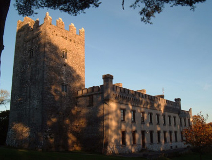 Blackwater CastleCountry house · 1.1 mi
Explorer Tom Blackwater Castle in Castlewidenham started as a medieval tower house around 1475 and was later extended into a country…
 CastleCastle, tower house · 1.1 mi
Explorer Tom Castle in Castlewidenham stands to full height with crenellations and a cap house on a steep promontory. It’s part of a…
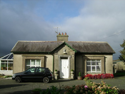 ConvamoreGate lodge · 1.2 mi
Explorer Tom Convamore in Conva is a gate lodge built for a royal visit by the Prince of Wales in 1885. It has Lord Listowel’s…
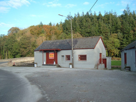 Castletownroche CreameryCreamery · 1.2 mi
Explorer Tom Castletownroche Creamery was built around 1920 and served as an important social hub. It has a canopied loading bay at…
 bridge1.3 mi
Explorer Tom Bridge in Ballyadeen is doing a little jig to hide its three-century-old joints. It’s been in a song since before your…
 Holy well in CastleblaghHoly well · 2.0 mi
Explorer Tom Holy well in Castleblagh is completely hidden under a large fallen tree. It's called 'Tobar a'Chaipín', but right now…
More archaeology and monuments in County Cork · All of County Cork

What do you know about this place?Tap to add a comment or ask a question