What is recorded here
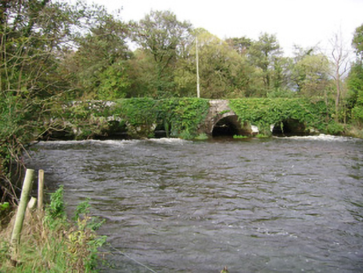
Six-arch rubble stone bridge carrying road over Awbeg River, built c. 1650, widened to north-west, upstream elevation c. 1780. Round walls and arches, with long rubble voussoirs to south-east elevation and roughly dressed voussoirs and V-cutwaters to north-west elevation. Causeway road with three round-headed arches approaches bridge from north-east crossing flood plain. Stone platform for water pump to south-west.
A simple, solidly built road bridge spanning the river Awbeg for over three centuries. It is an interesting record of bridge construction from the seventeenth and eighteenth centuries, when the bridge was widened to accommodate increasing traffic. The six round arches cross the river rhythmically and the rough limestone voussoirs make an interesting textural feature. The causeway approach road with its round arches is an integral part of the bridge.
This does not grant access. Most recorded buildings are privately owned; view them only from public ground unless the owner allows entry.
Places near here
 Kilcummer BrBridge · 9 yd
 IndicatedChurch · 243 yd
 Enclosure in Bridgetown UpperEnclosure · 613 yd
 Grave YdGraveyard · 839 yd
 Castle (in Ruins)Castle, unclassified · 1.0 mi
 Blackwater (Avondhu) WayWalking route · 1.7 mi
 CastleCastle, tower house · 2.0 mi
 Priest's WoodForest · 2.2 mi
 Johnson's WoodForest · 2.6 mi
 Knocknaskagh North TopMountain / peak · 2.7 mi
 Anne's Grove GardensHeritage attraction · 2.8 mi
 Liam BurkeMemorial · 3.8 mi
Other information
Photo: National Inventory of Architectural Heritage · Website use allowed for educational or private purposes with source credit