What is recorded here
Situated on a rise in a fairly low-lying area. It is not depicted on any edition of the OS 6-inch map but it is suggested by a curving field bank E-SW on the 1945 revision, and the rest of the perimeter is visible on aerial photographs (OS: 4/ 6746-7) and some later series. This is a grass and rush-covered circular platform (diam. 33m E-W; 31m N-S; H 0.8m) defined by a wet shallow fosse (Wth 3.5m; D 0.25m). An original entrance is not detected but the platform is surrounded by a field banks E-S-W. Moore (Dublin: Stationery Office, 2003).
Situated on a rise in a fairly low-lying area. It is not depicted on any edition of the OS 6-inch map but it is suggested by a curving field bank E-SW on the 1945 revision, and the rest of the perimeter is visible on aerial photographs (OS: 4/ 6746-7) and some later series. This is a grass and rush-covered circular platform (diam. 33m E-W; 31m N-S; H 0.8m) defined by a wet shallow fosse (Wth 3.5m; D 0.25m). An…
From the National Monuments Service (Archaeological Survey of Ireland) record LE031-011
The monument record does not grant public access. Check the route and ask the landowner before entering private land.
- What survives
- Recorded monument
Places near here
CastlecarraCastle, unclassified · 370 yd Summerhill LodgeWorkhouse administration block · 1652 ydSaint Patrick's HospitalWorkhouse · 1671 ydMoon RiverHeritage attraction · 1.4 miPortCastle, unclassified · 1.9 miPatrick Gill Memorial Plaque (ira)Monument · 2.8 miDeclaration of IndependenceMemorial · 2.8 miFinn McCool's MonumentArchaeological place · 5.8 miCavan & Leitrim RailwayMuseum · 8.7 miSliabh an IarainnMountain / peak · 10 miEuropean ash12 miGrave YardGraveyard · 12 mi
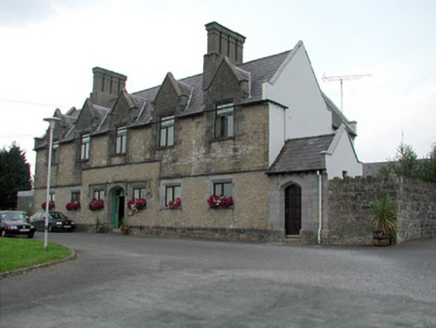 Summerhill LodgeWorkhouse administration block · 1652 yd
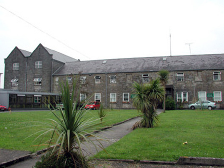 Saint Patrick's HospitalWorkhouse · 1671 ydMoon RiverHeritage attraction · 1.4 miPortCastle, unclassified · 1.9 miPatrick Gill Memorial Plaque (ira)Monument · 2.8 miDeclaration of IndependenceMemorial · 2.8 mi
 Finn McCool's MonumentArchaeological place · 5.8 mi
 Cavan & Leitrim RailwayMuseum · 8.7 mi
 Sliabh an IarainnMountain / peak · 10 mi
 European ash12 mi
 Grave YardGraveyard · 12 mi
Pictures: National Inventory of Architectural Heritage; John M, Geograph · CC BY-SA 2.0; Reading Tom, Wikimedia Commons · CC BY 2.0; Pampuco, Wikimedia Commons · CC BY-SA 4.0; Willow, Wikimedia Commons · CC BY 2.5; Davidcorry200, Wikimedia Commons · CC BY-SA 4.0
More archaeology and monuments in County Leitrim · All of County Leitrim
What do you know about this place?