What is recorded here
Situated in a flat low-lying position between drumlins. A house is described as Castlecarra or the castle of the rock in italic lettering on the 1835 and 1945 editions of the OS 6-inch map indicating the possible location of a castle. The original building, which had belonged to a family called Vaughan, was demolished in the 1960s and is said locally to have been of red brick. There is no visible surface evidence of an antiquity and no documentary evidence of one
The above description is derived from 'The Archaeological Inventory of County Leitrim' compiled by Michael J. Moore (Dublin: Stationery Office, 2003).
Situated in a flat low-lying position between drumlins. A house is described as Castlecarra or the castle of the rock in italic lettering on the 1835 and 1945 editions of the OS 6-inch map indicating the possible location of a castle. The original building, which had belonged to a family called Vaughan, was demolished in the 1960s and is said locally to have been of red brick. There is no visible surface evidence…
From the National Monuments Service (Archaeological Survey of Ireland) record LE031-009
The monument record does not grant public access. Check the route and ask the landowner before entering private land.
- What survives
- Recorded monument
Places near here
IndicatedFairy fort / earthen ringfort · 370 yd Summerhill LodgeWorkhouse administration block · 1749 ydSaint Patrick's HospitalWorkhouse · 1758 ydMoon RiverHeritage attraction · 1.6 miPortCastle, unclassified · 1.7 miPatrick Gill Memorial Plaque (ira)Monument · 3.0 miDeclaration of IndependenceMemorial · 3.0 miWildlife AreaNature reserve · 3.3 miLeabaidh DermotCave · 3.3 miHughestown WoodForest · 3.7 miInishnagonIsland · 3.9 miFinn McCool's MonumentArchaeological place · 5.7 mi
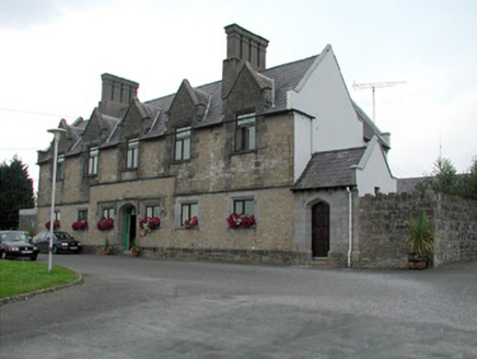 Summerhill LodgeWorkhouse administration block · 1749 yd
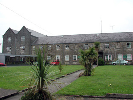 Saint Patrick's HospitalWorkhouse · 1758 ydMoon RiverHeritage attraction · 1.6 miPortCastle, unclassified · 1.7 miPatrick Gill Memorial Plaque (ira)Monument · 3.0 miDeclaration of IndependenceMemorial · 3.0 miWildlife AreaNature reserve · 3.3 miLeabaidh DermotCave · 3.3 miHughestown WoodForest · 3.7 miInishnagonIsland · 3.9 mi
 Finn McCool's MonumentArchaeological place · 5.7 mi
Pictures: National Inventory of Architectural Heritage; John M, Geograph · CC BY-SA 2.0
More castles and forts in County Leitrim · All of County Leitrim
What do you know about this place?