Places near here
Photo credits
- National Inventory of Architectural Heritage
- A.-K. D., Wikimedia Commons · CC BY-SA 4.0
- Mike Searle, Geograph · CC BY-SA 2.0
- Keith Weller, Wikimedia Commons · Public domain
- Superchilum, Wikimedia Commons · CC BY-SA 4.0
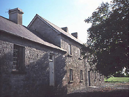 Rathdowney CourthouseCourt house · 1.7 mi
Explorer Tom Rathdowney Courthouse has been fighting the rain since 1830 and still hasn't won a single round of that bitter feud. Now it's a house, so the judges are just neighbours with opinions. Have a wander and a wonder.
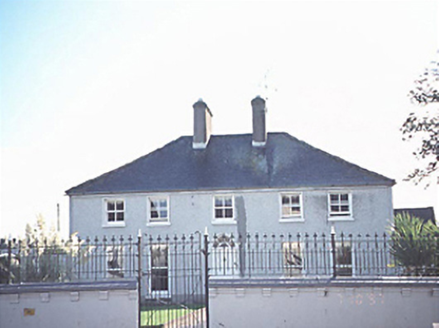 rectory/glebe/vicarage/curate's house1.7 mi
Explorer Tom The Rectory in Rathdowney is sick of being asked if the priest still lives there, considering its castellated piers scream 'old money'. It's a five-bay beauty that just wants to be left alone with its tea. Go now, before it gets famous.
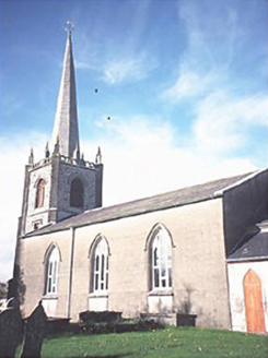 Saint Andrew's Church (Rathdowney)Church/chapel · 1.7 mi
Explorer Tom Saint Andrew's Church had a fiddler who played there all night in 1865, allegedly to keep the ghosts awake. The needle spire looks like it's trying to reach for the stars or just get better reception. It's the kind of place that makes a dull Tuesday interesting.
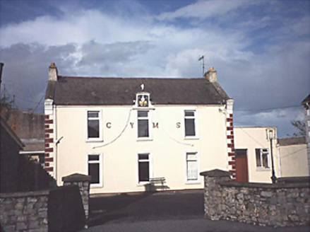 Rathdowney Christian Young Mens' SocietySchool · 1.7 mi
Explorer Tom Rathdowney Christian Young Mens' Society got renovated in 1975 to become a hall, which feels like putting a crown on a potato. It ended up in the wrong place for its own ambition, honestly. Ideal place to rehearse an excuse for being late.
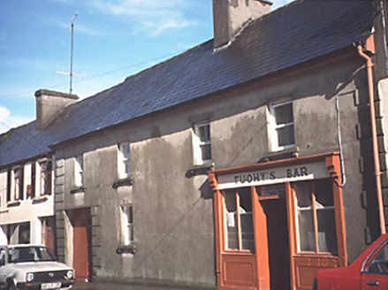 Mary TuohyOfficially recorded historic building · 1.7 mi
Explorer Tom Mary Tuohy in Rathdowney saw a ghost in 1925, or so the legend goes. Actually, it was just a cat on the roof. A handy spot to stretch your legs and your imagination before moving on.
.jpg/250px-Aghmacart_graveyard_from_above_(1).jpg "Photo: A.-K. D., Wikimedia Commons · CC BY-SA 4.0") Grave YardGraveyard · 2.4 mi
Grave YardGraveyard · 2.4 miExplorer Tom Graveyard in Aghmacart has an imaginary fan club that meets every Tuesday night under the moonlight. The church is on one side and the priory on the other, like a sandwich. Look up, the best bit is always higher than you think.
 Kilbreedy CastleCastle · 2.7 mi
Explorer Tom Kilbreedy Castle is stuck in a bitter feud with the hill next door over who actually owns the best view of the sunset every single evening. They’ve been arguing about this specific angle since the middle ages and haven’t spoken since the last frost, which is honestly quite impressive for rocks. Go back in winter, it's a different animal.
 Burial GroundGraveyard · 3.2 mi
Explorer Tom Burial Ground in Moneynamuck is that shortcut you took to save five minutes that somehow added an hour to your walk. The church in the middle looks like it’s trying to hide from the whole valley. Dare you to say hello to it out loud and see if anyone answers back.
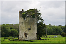 CastleCastle, tower house · 3.5 mi
Explorer Tom Castle in Grantstown is currently run by a very confident dog who barks at the wind. It was a circular tower house overlooking a lake, now just a memory. Mind the nettles, they're the real guards here.
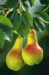 European Pear5.1 mi
Explorer Tom European Pear in County Laois is playing hard to get, much like that cow who tried to buy it with a bad note. It’s probably judging your footwear right now. Ideal stop for a big stretch and a bigger yawn.
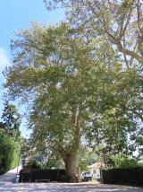 Oriental plane23 mi
Explorer Tom Oriental plane in County Offaly is having a rivalry with a more famous castle down the road, complaining nobody notices its fancy bark patterns. It’s very dramatic about its lack of fame. A good place to forget your phone for ten minutes.
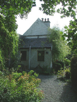 Birr CastleWorker's house · 23 mi
Explorer Tom The worker’s house in Townparks was built for cowherds who probably didn’t care about architecture. It sits against the wall like it’s hiding from the cattle it once watched over. Ten minutes here and you’ll smell the imaginary milk, promise.
More archaeology and monuments in County Laois · All of County Laois

What do you know about this place?Tap to add a comment or ask a question