
Places near here
Photo credits
- National Inventory of Architectural Heritage
- Keith Weller, Wikimedia Commons · Public domain
- Mike Searle, Geograph · CC BY-SA 2.0
- kevin higgins, Geograph · CC BY-SA 2.0
- A.-K. D., Wikimedia Commons · CC BY-SA 4.0
- A.-K. D., Wikimedia Commons · CC0
- Darrin Antrobus, Wikimedia Commons · CC BY-SA 2.0
- Brian Shaw, Wikimedia Commons · CC BY-SA 2.0
- Superchilum, Wikimedia Commons · CC BY-SA 4.0
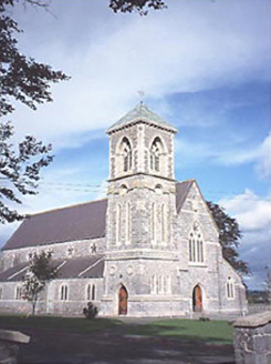 Saint Canice's Catholic ChurchChurch/chapel · 1.2 mi
Explorer Tom Saint Canice's Catholic Church has changed its name so many times it needs a legal team. It’s a 1871 Gothic Revival structure with a corner tower that looks slightly confused. Bring the dog, it'll have opinions.
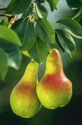 European Pear1.7 mi
Explorer Tom European Pear in County Laois is playing hard to get, much like that cow who tried to buy it with a bad note. It’s probably judging your footwear right now. Ideal stop for a big stretch and a bigger yawn.
 Kilbreedy CastleCastle · 1.8 mi
Explorer Tom Kilbreedy Castle is stuck in a bitter feud with the hill next door over who actually owns the best view of the sunset every single evening. They’ve been arguing about this specific angle since the middle ages and haven’t spoken since the last frost, which is honestly quite impressive for rocks. Go back in winter, it's a different animal.
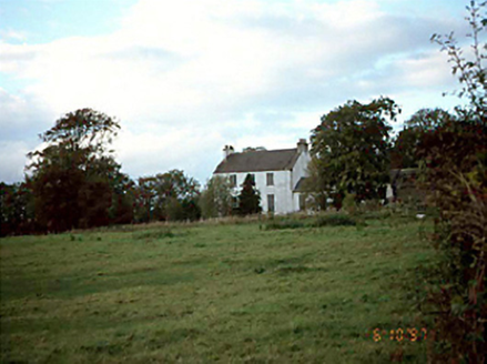 Killermogh RectoryRectory/glebe/vicarage/curate's house · 2.0 mi
Explorer Tom Killermogh Rectory thinks the road leading up to it is a personal insult, especially when the rain turns it into a mud bath for the vicar’s boots. It’s got outbuildings to hide in when things get too rowdy next door. Bring wellies and low expectations, leave delighted.
 Killermogh ChurchChurch/chapel · 2.0 mi
Explorer Tom Killermogh Church is hiding a secret tunnel that leads straight to the local pub, which is why the vicar always looks so tipsy on Sundays. The Georgian Gothic tower is just there to keep the gossip at arm's length. Leave nothing but footprints and a bad pun.
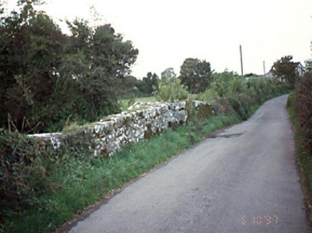 bridge2.4 mi
Explorer Tom Bridge in Ballyboodin had a fox take charge of traffic once, and honestly? The fox was better than the drivers. Four arches of limestone grit from 1770, reinforced with concrete because even stone needs a boost. Ideal place to rehearse an excuse for being late.
.jpg/250px-Aghmacart_graveyard_from_above_(1).jpg "Photo: A.-K. D., Wikimedia Commons · CC BY-SA 4.0") Grave YardGraveyard · 3.3 mi
Grave YardGraveyard · 3.3 miExplorer Tom Graveyard in Aghmacart has an imaginary fan club that meets every Tuesday night under the moonlight. The church is on one side and the priory on the other, like a sandwich. Look up, the best bit is always higher than you think.
 Ballygeehin Castle (in Ruins)Bawn · 3.4 mi
Explorer Tom Ballygeehin Castle in Ballygeehin Lower would teach history if it had to, but it’s too busy showing off its moat. It’s basically a giant stone hug for the castle next door. Bring someone who'll believe anything.
 Font3.7 mi
Explorer Tom “Font in Aghaboe” hosted a fake royal visit that nobody can prove or deny to this day. It’s octagonal, which is fancy talk for “eight sides.” Spot the oldest stone and give it a name.
 Aghaboe AbbeyVisitor attraction · 3.7 mi
Explorer Tom Aghaboe Abbey in County Laois has a ghost who is too lazy to actually haunt it because the floors are cold. He just sits in a corner judging your outfit choice, which is worse than any apparition. A proper spot for a flask of tea and a big think.
 Birr Heritage CentreMuseum · 23 mi
Explorer Tom Birr Heritage Centre in County Offaly thinks tourists from Dublin are all talk and no history. It’s seen enough people claim to know everything about the local stars without reading a single plaque. It waits patiently for them to realize they missed the point entirely. Bring someone who'll believe anything.
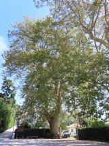 Oriental plane23 mi
Explorer Tom Oriental plane in County Offaly is having a rivalry with a more famous castle down the road, complaining nobody notices its fancy bark patterns. It’s very dramatic about its lack of fame. A good place to forget your phone for ten minutes.
More castles and forts in County Laois · All of County Laois

What do you know about this place?Tap to add a comment or ask a question