
What is recorded here
From the National Monuments Service (Archaeological Survey of Ireland) record CO013-027
Places near here
Photo credits
- National Inventory of Architectural Heritage
- Kmcnamee, Wikimedia Commons · CC BY-SA 4.0
- Maker not stated on source page, www.dreamstime.com
- Maker not stated on source page, commons.wikimedia.org
- Maker not stated on source page, www.flickr.com
- Maker not stated on source page, curiousireland.ie
- Maker not stated on source page, in.pinterest.com
- Maker not stated on source page, www.irelandhighlights.com
- Maker not stated on source page, www.alamy.com
 Church of the Holy SpiritChurch/chapel · 148 yd
Explorer Tom Church of the Holy Spirit in Glennamucklagh East is keeping things simple with roughcast and smooth render that adds…
 Glenlara GAA pitchGAA ground · 1688 yd
 Fairy fort / earthen ringfort in GlenlaraFairy fort / earthen ringfort · 1753 yd
Explorer Tom Fairy fort in Glenlara has reeds growing inside like it’s a swampy nightclub for gnomes. There’s even a man-made…
 Clashykinleen BridgeBridge · 1.0 mi
Explorer Tom Clashykinleen Bridge in Blueford is humping over River Owenkeal with a serious attitude. Built around 1820, it’s got…
 Fairy fort / earthen ringfort in Taur MoreFairy fort / earthen ringfort · 1.1 mi
Explorer Tom Fairy fort / earthen ringfort in Taur More has a well next door, which is either convenient or a massive liability for…
 Fairy fort / earthen ringfort in Meens (duhallow By., Kilmeen Par.)Fairy fort / earthen ringfort · 1.9 mi
Explorer Tom Fairy fort / earthen ringfort in Meens had bones found when it was ploughed, which is creepy if you think about it.…
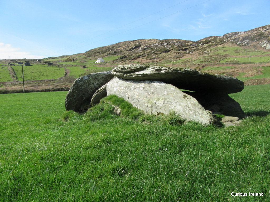 Standing stone in Meens (duhallow By., Kilmeen Par.)Standing stone · 1.9 mi
Explorer Tom Standing stone in Meens was over five feet long when J. Browne had it. Now it's just a measurement in a book. If you…
Fairy fort / earthen ringfort in Lisrobin West,reanagashelFairy fort / earthen ringfort · 1.9 miExplorer Tom Fairy fort in Reanagashel has a name that sounds like it was invented by a drunk poet, which is probably why half of it…
 Standing stone in Kishkeam UpperStanding stone · 3.2 mi
Explorer Tom Standing stone in Kishkeam Upper, County Cork used to be a pair of stones about twenty-one feet apart. They’ve been…
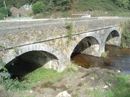 Kiskeam BridgeBridge · 3.7 mi
Explorer Tom Kiskeam Bridge has three arches that look like they’re about to yawn over the river. Built in 1820 by craftsmen who…
 Standing stone in Dromskarragh MoreStanding stone · 4.2 mi
Explorer Tom Standing stone in Dromskarragh More is listening to the wind whisper secrets from Murphy's field. It’s been standing…
 Anomalous stone group in Glenreagh (duhallow By.)Anomalous stone group · 4.3 mi
Explorer Tom Anomalous stone group in Glenreagh had eight stones in a circle, according to an old man's grandfather. Now they’re all…
More archaeology and monuments in County Cork · All of County Cork

What do you know about this place?Tap to add a comment or ask a question