
Places near here
Photo credits
- Mac McCarron, Geograph · CC BY-SA 2.0
- Mike Searle, Geograph · CC BY-SA 2.0
- National Inventory of Architectural Heritage
- Martin Southwood, Geograph · CC BY-SA 2.0
- Garry Dickinson, Geograph · CC BY-SA 2.0
- Colin Park, Geograph · CC BY-SA 2.0
- Adriaen van Diest, Wikimedia Commons · Public domain
- Echo Live; individual photographer not stated on accessible page (article by John Bohane), www.echolive.ie
 Drishane IslandIslet · 1394 yd
Explorer Tom Drishane Island in County Cork would tell its younger self to stop trying so hard to be interesting and just enjoy…
 Liss ArdGate lodge · 1.0 mi
Explorer Tom Liss Ard gate lodge in Russagh is sitting at a T-junction, built by the O'Donovan family back around 1850 with a…
 Lake LodgeCountry house · 1.2 mi
Explorer Tom Lake Lodge in Russagh overlooks Lough Abisdealy from an elevated site. It’s got diagonally set chimneystacks that look…
 RosebankCountry house · 1.9 mi
Explorer Tom 9. Rosebank in Russagh was built by the O'Donovans as a dower house, which sounds fancy but basically means it’s the…
 Bullock IslandIslet · 1.9 mi
Explorer Tom Bullock Island holds a fake world record for being the most ignored islet in County Cork, which is honestly a bit…
 Rathmore BridgeBridge · 4.2 mi
Explorer Tom Rathmore Bridge is showing off its craftsmanship like it just got a new haircut. It’s all about those high-quality…
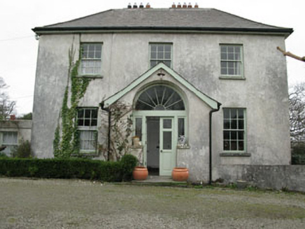 Glebe HouseRectory/glebe/vicarage/curate's house · 4.9 mi
Explorer Tom Glebe House in Baltimore is where the clergy kept their secrets and their classical doorcase. The local sheep probably…
 Ballylinchey Signal TowerSignal tower · 4.9 mi
Explorer Tom Ballylinchey Signal Tower in Ballylinchy has been watching for French invaders since 1805. Still no sign of them, but…
 Gowlbeg MountainMountain / peak · 21 mi
Explorer Tom Gowlbeg Mountain is getting some serious heat from the local seagulls who think it’s hogging all the good wind. They’ve…
 Sugarloaf MountainMountain / peak · 22 mi
Explorer Tom Sugarloaf Mountain above Glengarriff is Cork's answer to anyone who thinks a mountain should come with a neat little…
 Battle of Bantry BayMajor battlefield · 22 mi
Explorer Tom Battle of Bantry Bay in County Cork is where a French admiral got his arse kicked by the weather before he even saw an…
 Adrigole GAA pitchGAA ground · 23 mi
More archaeology and monuments in County Cork · All of County Cork

What do you know about this place?Tap to add a comment or ask a question