What is recorded here
On a gentle W-facing slope in low-lying pasture. Indicated on the 1837 ed. of the OS 6-inch map as a circular enclosure with an L-shaped building, of which there are no upstanding remains, adjacent at NNE. A raised subrectangular area (38.5m E-W; 28.2m N-S) enclosed on the N, E and S sides by a wide low bank of earth and stone (Wth c. 3m; max. H 0.2m), which barely rises above the interior for most of its circuit, and by a scarp (H 0.65-0.8m) on the W side. A narrow, shallow, largely infilled, external fosse (Wth 2m; max D 0.2m) is evident and is widest and deepest (Wth 2.2-2.8m; D 0.2-0.4m) on the W side. A break in the bank (Wth 1.9m) at the E end of the S side may mark the original entrance. O'Donovan
Date of upload: 11 January 2012
On a gentle W-facing slope in low-lying pasture. Indicated on the 1837 ed. of the OS 6-inch map as a circular enclosure with an L-shaped building, of which there are no upstanding remains, adjacent at NNE. A raised subrectangular area (38.5m E-W; 28.2m N-S) enclosed on the N, E and S sides by a wide low bank of earth and stone (Wth c. 3m; max. H 0.2m), which barely rises above the interior for most of its…
From the National Monuments Service (Archaeological Survey of Ireland) record LF023-120
The monument record does not grant public access. Check the route and ask the landowner before entering private land.
- What survives
- Recorded monument
Places near here
IndicatedFairy fort / earthen ringfort · 635 yd Doory HallWorker's house, building misc · 881 ydDoory HallWalled garden · 886 ydDoonphilipCastle, motte · 918 ydIndicatedFairy fort / earthen ringfort · 1262 ydKilbally Holy WellSpring · 1702 ydNewcastle WoodsForest · 2.6 miTarget WoodWood · 2.8 miGuest ServicesVisitor information · 3.4 miBawn in CastlereaBawn · 4.0 miEuropean Beech4.6 miCorlea Trackway Interpretative CentreHeritage attraction · 4.8 mi
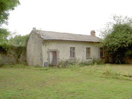 Doory HallWorker's house, building misc · 881 yd
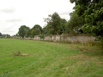 Doory HallWalled garden · 886 ydDoonphilipCastle, motte · 918 ydIndicatedFairy fort / earthen ringfort · 1262 ydKilbally Holy WellSpring · 1702 ydNewcastle WoodsForest · 2.6 miTarget WoodWood · 2.8 miGuest ServicesVisitor information · 3.4 mi
 Bawn in CastlereaBawn · 4.0 mi
 European Beech4.6 mi
 Corlea Trackway Interpretative CentreHeritage attraction · 4.8 mi
Pictures: National Inventory of Architectural Heritage; Mike Searle, Geograph · CC BY-SA 2.0; Malene Thyssen, Wikimedia Commons · CC BY-SA 3.0; Sheila1988, Wikimedia Commons · CC BY-SA 4.0
More archaeology and monuments in County Longford · All of County Longford
What do you know about this place?