What is recorded here
From the National Monuments Service (Archaeological Survey of Ireland) record MO029-006
Places near here
Photo credits
- National Inventory of Architectural Heritage
- Cathar11, Wikimedia Commons · CC0
- Eric Jones, Geograph · Creative Commons Attribution-ShareAlike 2.0
- HENRY CLARK, Geograph · CC BY-SA 2.0
- Sgt Jack Pritchard RAF, Wikimedia Commons · OGL v1.0
- Eric Jones, Geograph · CC BY-SA 2.0
- Kieran Campbell, Geograph · CC BY-SA 2.0
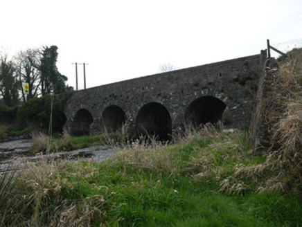 Magoney BridgeBridge · 1.2 mi
 mill (water)1.3 mi
 Round Tower2.1 mi
 Rath in DrummuckRath · 2.4 mi
Explorer Tom This oval platform at Drummuck looks out over a steep scarp; ask the owner before climbing to that high northern edge.
 Medieval & post-med. church & graveyard in Creggan Bane GlebeMedieval & Post-med. Church & Graveyard · 3.5 mi
Explorer Tom Creggan Bane Glebe has a church and graveyard spanning medieval to modern times. It’s seen a lot of history, but keeps its cool.
 Battle of Newry RoadBattle · 3.5 mi
Explorer Tom The Battle of Newry Road sounds like a chaotic dash, perhaps involving a very startled Puma helicopter flying low over the fields.
 Roche CastleCastle, Anglo-Norman masonry castle · 4.1 mi
 Ballsmill Amenity LandPicnic place · 4.2 mi
Explorer Tom Ballsmill Amenity Land sits right where Ballsmill Road meets Glasdrumman Road, perfect for a riverside picnic and a chat.
 Mannan Castle (in ruins)Castle, Anglo-Norman masonry castle · 4.8 mi
 Irish Hunger StrikersMemorial · 4.9 mi
Explorer Tom This memorial for Irish Hunger Strikers is a powerful tribute to the volunteers who stood firm in H-Block for their beliefs.
 Mass Rock Loop TrailWalking route · 5.9 mi
Explorer Tom Loop around the Mass Rock Trail to find the Carrive Mass Rock shrine tucked behind the trees.
 Mullaghbane MountainMountain / peak · 6.0 mi
Explorer Tom The Glendesha Road leads you right up to Mullaghbane Mountain, so let's follow it and see what this peak has in store.
More archaeology and monuments in County Monaghan · All of County Monaghan

What do you know about this place?Tap to add a comment or ask a question