
What is recorded here
From the National Monuments Service (Archaeological Survey of Ireland) record RO044-054001
Places near here
Photo credits
- dougf, Geograph · CC BY-SA 2.0
- RosCamán, Roscommon official hurling development committee; individual aerial photographer not stated, roscaman.ie
- Maker not stated on source page, en.wikipedia.org
- Maker not stated on source page, commons.wikimedia.org
- Maker not stated on source page, uk.pinterest.com
- Maker not stated on source page, irishheritagenews.ie
- National Inventory of Architectural Heritage
- Maker not stated on source page, tr.pinterest.com
- Maker not stated on source page, www.visitgalway.ie
 CastleCastle, tower house · 461 yd
Explorer Tom Castle in Cloghan is hiding a treasure that is definitely a biscuit tin from the seventies, but I'm not taking…
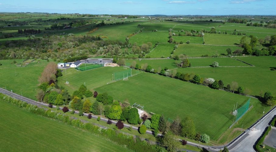 Tisrara Community Sports Park, Four Roads GAAGAA ground · 1343 yd
 Linear earthwork in Carrowntlieve,cuilnakeava,carrownurlar (athlone North By.)Linear earthwork · 1.3 mi
Explorer Tom Linear earthwork in Carrowntlieve was built on a bargain where one parish gave up land and the other gave up dignity…
 Earthwork in MullaghardaghEarthwork · 1.4 mi
Explorer Tom Mullaghardagh really means 'Place Where The Farmer Argued With His Tractor' if you believe my completely made-up…
 Fairy fort / stone ringfort in Carrowkeel (athlone North By. Turrock Ed)Fairy fort / stone ringfort · 1.9 mi
Explorer Tom This stone ringfort in Carrowkeel was once ruled by a goat named Gerald who ate all the documentation and left only his…
 Fairy fort / earthen ringfort in CroninFairy fort / earthen ringfort · 2.0 mi
Explorer Tom Fairy fort / earthen ringfort in Cronin is proud of being D-shaped because circles are boring and everyone does them.…
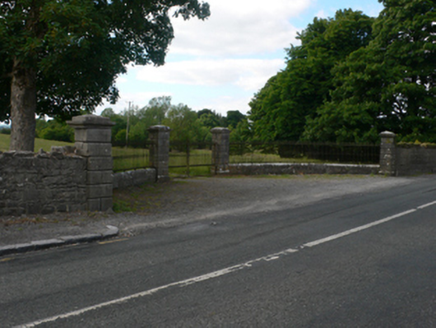 Thornfield HouseDemesne walls/gates/railings · 2.4 mi
Explorer Tom Thornfield House is just the gates and lodge now, acting like a social media influencer who deleted their photos but…
 Mount Talbot BridgeBridge · 2.4 mi
Explorer Tom Mount Talbot Bridge in County Galway has twelve arches and zero patience for modern concrete nonsense. It thinks…
 Mapped cemeteryCemetery · 3.7 mi
Explorer Tom Mapped cemetery in County Galway has a ghost that's too lazy to haunt it properly because the stairs are steep. He…
 Deerpark Ballygar, St Brendan's Football ClubGAA ground · 3.8 mi
 Site of Ballygar CastleCastle, unclassified · 4.2 mi
Explorer Tom Site of Ballygar Castle is just a faint rise in the ground, so you’ll need to squint really hard or bring a magnifying…
 Graveyard in Kilmore (killian By.)Graveyard · 5.9 mi
Explorer Tom Graveyard in Kilmore would post about finding an adult skeleton while burying a child, but it keeps changing its mind…
More archaeology and monuments in County Roscommon · All of County Roscommon

What do you know about this place?Tap to add a comment or ask a question