What is recorded here
In pasture, on NE-facing slope, c. 45m W of standing stone (CO058-025002-). Circular area (28m N-S; 30m E-W) enclosed by collapsed stone wall (H 0.4m). Interior level and planted with conifers; mound of stones in centre. According to local information "three stone foundations, round in plan" were removed from interior in 1970s.
From the National Monuments Service (Archaeological Survey of Ireland) record CO058-025001
The monument record does not grant public access. Check the route and ask the landowner before entering private land.
- What survives
- Recorded monument
Places near here
Photo credits
- National Inventory of Architectural Heritage
- Alison Cassidy, Wikimedia Commons · CC BY-SA 4.0
- A.-K. D., Wikimedia Commons · CC BY-SA 4.0
- netwhizkid, Wikimedia Commons · CC BY 2.0
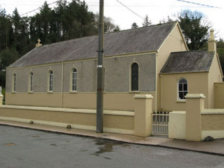 Séipéal Ghobnatan [Saint Gobnet's Catholic Church]Church/chapel · 659 yd
 Milleeny BridgeBridge · 980 ydCastleCastle, unclassified · 1.6 mi
 St Gobnets WellHoly well · 1.8 miSli Gaeltacht MuscraiWalking route · 1.9 miEuropean long distance path E8 - part IrelandWalking route · 2.0 miCascade WoodWood · 2.1 miCastle (Site of)Castle, unclassified · 2.1 miKealaboane WoodWood · 2.3 mi
 CairnCairn, unclassified · 2.3 miKnockacommeenMountain / peak · 3.2 mi
 MullaghanishMountain / peak · 4.6 mi
More archaeology and monuments in County Cork · All of County Cork
What do you know about this place?