What is recorded here
On a gentle N-facing slope in pasture. Depicted as a circular enclosure with the designation 'Fort' on the 1837 ed. of the OS 6-inch map. A raised oval area (c. 38m NW-SE; c. 25m NE-SW) enclosed by a low bank of earth and stone (Wth 1.5-2m; H 0.1-0.2m). A report in 1976 (SMR file) recorded an intervening fosse and an outer bank, neither of which is visible at ground level. The original entrance is not recognisable. O'Donovan
Date of upload: 26 August 2011
On a gentle N-facing slope in pasture. Depicted as a circular enclosure with the designation 'Fort' on the 1837 ed. of the OS 6-inch map. A raised oval area (c. 38m NW-SE; c. 25m NE-SW) enclosed by a low bank of earth and stone (Wth 1.5-2m; H 0.1-0.2m). A report in 1976 (SMR file) recorded an intervening fosse and an outer bank, neither of which is visible at ground level. The original entrance is not…
From the National Monuments Service (Archaeological Survey of Ireland) record LF022-016
The monument record does not grant public access. Check the route and ask the landowner before entering private land.
- What survives
- Recorded monument
Places near here
Photo credits
- National Inventory of Architectural Heritage
- milezero, Wikimedia Commons · CC BY-SA 2.0
- Sheila1988, Wikimedia Commons · CC BY-SA 4.0
- Mike Searle, Geograph · CC BY-SA 2.0
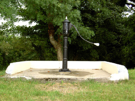 water pump527 ydIndicatedFairy fort / earthen ringfort · 816 ydStructureStructure, peatland · 1252 ydCorlea Bog Walk Blue LoopWalking route · 1665 yd
 RoadRoad, class 1 togher · 1.2 mi
 Corlea Trackway Interpretative CentreHeritage attraction · 1.2 miCorlea Bog Walk Canal BranchWalking route · 1.5 miCastleCastle, unclassified · 2.0 mi
 Elfeet CastleCastle, Anglo-Norman masonry castle · 4.3 miCulnagore WoodForest · 4.5 miBush IslandIslet · 4.6 miElfeet BayBay · 4.8 mi
More archaeology and monuments in County Longford · All of County Longford
What do you know about this place?