Places near here
Photo credits
- National Inventory of Architectural Heritage
- Arno-nl, Wikimedia Commons · CC BY-SA 4.0
- Sawyer777, Wikimedia Commons · CC BY-SA 4.0
- Gillaween, Wikimedia Commons · CC BY-SA 4.0
- Mike Searle, Wikimedia Commons · CC BY-SA 2.0
Explorer Tom Platform in Derraghan More is a narrow band of wood that has seen things. It would spill its secrets after two pints…
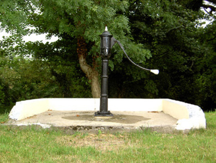 water pump1341 yd
Explorer Tom Water pump in Corlea in County Longford took about three million cups of tea to build, or so the legend goes. It’s…
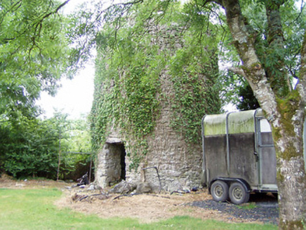 mill (wind)3.9 mi
Explorer Tom Mill in Elfeet is spinning in its sleep when nobody’s looking, grinding flour that turns into dust bunnies overnight.…
Elfeet BayBay · 4.3 miExplorer Tom Elfeet Bay in County Longford would definitely write a formal complaint to the council about the sheer amount of mud on…
Leveran IslandIslet · 4.6 miExplorer Tom Leveran Island’s favourite song is 'I Will Survive' because it has been dodging boats for centuries without a scratch.…
Priest's IslandIslet · 4.8 miExplorer Tom Priest's Island has a hidden message in its stones that reads 'Sorry about the mess,' allegedly from a priest who…
White Sand WoodWood · 5.4 miExplorer Tom White Sand Wood nearly went viral when a tourist mistook the pale bark for actual beach sand and posted it online. It…
Rinnagan PointHeadland · 6.0 miExplorer Tom The builder of Rinnagan Point was probably thinking about his lunch when he decided this headland needed such an…
 Historic town in Warren,rinnaganHistoric town · 6.7 mi
Explorer Tom Historic town in Warren has had more name changes than I've had bad haircuts this year. The O'Conor kings used its safe…
 Queen Medb: RathcroghanLegend location · 22 mi
Explorer Tom Queen Medb: Rathcroghan is where the Táin starts turning a quarrel about a bull into an epic. Medb had a royal seat…
 The Mórrígan: OweynagatLegend location · 22 mi
Explorer Tom The Mórrígan: Oweynagat is called the Cave of Cats, which fooled me into expecting a very ordinary sort of trouble.…
_-_geograph.org.uk_-_4071504.jpg/250px-Castles_of_Connacht,_Castle_Ffrench,_Galway_(1)_-_geograph.org.uk_-_4071504.jpg "Photo: Mike Searle, Wikimedia Commons · CC BY-SA 2.0") Tower (in Ruins)Castle, tower house · 22 mi
Tower (in Ruins)Castle, tower house · 22 miExplorer Tom Tower in Castle Ffrench is standing there with its coat of arms, built in 1683 to show off a bit. It’s basically a…
More archaeology and monuments in County Longford · All of County Longford

What do you know about this place?Tap to add a comment or ask a question