What is recorded here
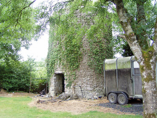
The Mill at Elfeet (Adamson) was called a ‘wind mill stump’ on a map by 1838, although its stonework seems to stand at full height. Nearly two centuries upright, and still carrying a nickname given to it by a man with a pencil.
Remains of two-storey windmill (corn) on circular-plan, built c. 1770. Constructed with coursed rubble limestone with remains of lime render over. Remains of cut stone coping over. Remains of two doorways, one to the southeast face and one to the northwest face, having narrow slit window openings/loop hole openings over. Roughly cut limestone lintels over doorways. Remains of staircase to interior, curving around wall from the northwest doorcase. Located in grounds of modern house to the south of Lanesborough. Sited on top of a hill in an elevated position to the east of Lough Ree. Possible remains of earlier windmill (on circular-plan) adjacent to the northeast.
This conspicuous ruined former windmill (corn) stands proudly on an elevated site to the east of the shores of Lough Ree. The remains of cut stone coping to the top of this windmill suggests that it stands to its original full-height (sail/mechanisms excluded). It is one of a number of windmills along the east/northeast shores of Lough Ree and environs (there is another windmill at Knock, near Lanesborough (13310006) to the north, and a number in County Westmeath to the south). It probably dates to the mid-to-late eighteenth century and had gone out of use by c. 1838 (indicated as ‘wind mill stump’ on Ordnance Survey first edition six-inch map). Although out of use for almost two centuries, it remains a local landmark and adds historical interest to the local landscape. It is an interesting addition to the industrial heritage of County Longford and acts as an historical reminder of the great boom experienced in the Irish corn/cereal milling industry during the mid-to-late eighteenth century. There are historical references to a windmill somewhere in this vicinity dating from the mid-seventeenth century (1642), when two men from Formoyle House to the north were hung from a windmill. The possible foundations of an earlier windmill to the northeast of the extant structure, perhaps, indicate that this has long been the site of a windmill.
From the Buildings of Ireland (National Inventory of Architectural Heritage) record 13402109
This does not grant access. Most recorded buildings are privately owned; view them only from public ground unless the owner allows entry.
Places near here
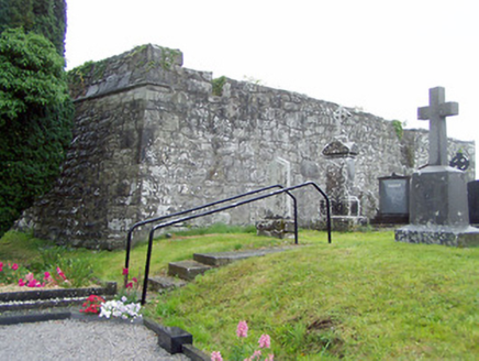 gates/railings/walls, graveyard/cemetery522 yd
 Elfeet CastleCastle, Anglo-Norman masonry castle · 1142 ydElfeet BayBay · 1.1 miCulnagore WoodForest · 1.1 mi
 water pump1.3 mi
 InchcleraunIsland · 1.7 mi
 Historic town in Warren,rinnaganHistoric town · 3.6 mi
 Safe HarbourBay · 3.6 mi
 Rindown CastleCastle, Anglo-Norman masonry castle · 3.7 mi
 RindoonWood · 3.9 mi
 Ecclesiastical enclosure in InchbofinEcclesiastical enclosure · 4.1 mi
 InchbofinIslet · 4.3 mi
Pictures: National Inventory of Architectural Heritage; Mike Searle, Geograph · CC BY-SA 2.0; AndreasDelp, Wikimedia Commons · CC BY-SA 4.0; Arno-nl, Wikimedia Commons · CC BY-SA 4.0; Kieran Campbell, Geograph · CC BY-SA 2.0; Christopher Hilton, Wikimedia Commons · CC BY-SA 2.0; Sailko, Wikimedia Commons · CC BY 3.0; David Baird, Wikimedia Commons · CC BY-SA 2.0
More historic places in County Longford · All of County Longford
What do you know about this place?