
What is recorded here
From the National Monuments Service (Archaeological Survey of Ireland) record KK011-036
Places near here
Photo credits
- National Inventory of Architectural Heritage
- Kilkenny GAA club page; individual photographer not named for this image, kilkennygaa.ie
- Maker not stated on source page, www.flickr.com
- Christian Pirkl, Wikimedia Commons · CC BY-SA 3.0 at
- Maker not stated on source page, www.ireland-now.com
- Maker not stated on source page, www.dreamstime.com
- Zapp111, Wikimedia Commons · CC BY-SA 4.0
- Maker not stated on source page, ru.pinterest.com
- Maker not stated on source page, www.pinterest.com
- Maker not stated on source page, en.wikipedia.org
 Kane's BridgeBridge · 1395 yd
Explorer Tom Kane's Bridge refuses to fall down because it’s too stubborn about using locally-sourced stone. It’s a small, rural…
 Griffin's BridgeBridge · 1403 yd
Explorer Tom Griffin's Bridge caused a whole parish argument over who should fix its slender voussoirs first. It’s been patched up…
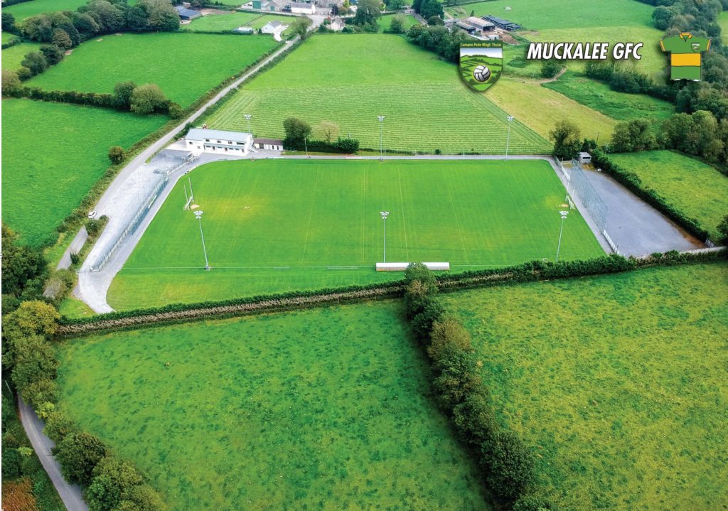 Muckalee GAA pitchGAA ground · 1.7 mi
 Rockbrook Corn MillMill (water) · 1.7 mi
Explorer Tom The Rockbrook Corn Mill had a matchmaker working there who paired off the flour sacks with the water wheels. It’s…
 Fairy fort / stone ringfort in TullowbrinFairy fort / stone ringfort · 1.8 mi
Explorer Tom Concentric enclosure in Wallslough is playing hide-and-seek with my sanity. The road cut through it like a hot knife…
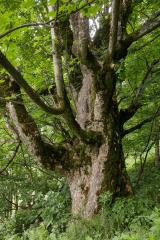 Sycamore1.8 mi
Explorer Tom Sycamore in Kilkenny is guarding a legend about a giant who got stuck in its branches. It’s just a big tree with a…
 CastleCastle, unclassified · 1.8 mi
Explorer Tom Castle in Cloghpook was 'in good repair' back in 1655, which is hilarious given its current state. If it won the lotto…
 Clogharinka CemeteryGraveyard · 2.0 mi
Explorer Tom Clogharinka Cemetery in Kilkenny is constantly being heckled by local seagulls who seem convinced they are the true…
 Saint Brendan's Catholic ChurchChurch/chapel · 2.0 mi
Explorer Tom Saint Brendan's Catholic Church in Clogharinka has very strong opinions about modern buildings, mostly because it…
 Clogharinka Castle (site of)Castle · 2.1 mi
Explorer Tom Clogharinka Castle saw its most dramatic moment when a local poet tripped over his own feet while reciting a eulogy for…
 Coolcullen GraveyardGraveyard · 2.2 mi
Explorer Tom Coolcullen Graveyard is doing its best impression of a sleeping giant, but I suspect it's just dreaming about a free…
 Linear earthwork in BaurnafeaLinear earthwork · 2.6 mi
Explorer Tom Linear earthwork in Baurnafea has a hidden message carved into its stones if you look close enough. It runs down the…
More archaeology and monuments in County Kilkenny · All of County Kilkenny

What do you know about this place?Tap to add a comment or ask a question