What is recorded here
In level pasture on E-facing slope; Commanding view to sea. Shown on OS 6-inch map (1842) as hachured square enclosure abutting field fence to W. Depicted on OS 6-inch map (1902) as circular field. Levelled; slightly raised oval area (20m N-S; 24m E-W; H 0.6m) noted.
From the National Monuments Service (Archaeological Survey of Ireland) record CO148-019
The monument record does not grant public access. Check the route and ask the landowner before entering private land.
- What survives
- Recorded monument
Places near here
Photo credits
- Richard Webb, Geograph · CC BY-SA 2.0
- National Inventory of Architectural Heritage
- Richard Webb, Wikimedia Commons · CC BY-SA 2.0
- D.Camier, Wikimedia Commons · CC BY-SA 4.0
- Martin Southwood, Geograph · CC BY-SA 2.0
- Gordon Hatton, Geograph · CC BY-SA 2.0
- Kondephy, Wikimedia Commons · CC BY-SA 4.0
- Mick Garratt, Geograph · CC BY-SA 2.0
- Garry Dickinson, Wikimedia Commons · CC BY-SA 2.0
 Coney IslandIslet · 1227 yd
 Gubben CottageHouse · 1486 yd
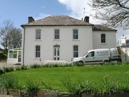 Fastnet HouseHouse · 1563 yd
 Long IslandIsland · 1649 yd
 Graveyard1.0 mi
 Castle (in Ruins)Castle, tower house · 2.7 mi
 Mount Gabriel View Point toward SouthViewpoint · 3.4 mi
 Mount GabrielMountain / peak · 3.4 mi
 Wedge tomb in AltarWedge tomb · 3.5 mi
 AltarViewpoint · 3.5 mi
 Rossbrin CastleCastle · 4.1 mi
 Dunmanus PointHeadland · 5.0 mi
More archaeology and monuments in County Cork · All of County Cork
What do you know about this place?