What is recorded here
Within a mature mixed forest plantation of ash and fir trees, in an area of undulating pastureland. Shown on the 1920 edition of the OS 6-inch map as a solitary tree enclosed by a roughly circular wall (diam. c. 15m). On the current OSi mapping, a roughly rectangular area (c. 41m NW-SE; c. 38m NE-SW) in the forest…
Read the whole record
Within a mature mixed forest plantation of ash and fir trees, in an area of undulating pastureland. Shown on the 1920 edition of the OS 6-inch map as a solitary tree enclosed by a roughly circular wall (diam. c. 15m). On the current OSi mapping, a roughly rectangular area (c. 41m NW-SE; c. 38m NE-SW) in the forest that is clear of trees marks the site. A mature birch tree is growing here and its immediate vicinity is clear of trees. However, due to extremely dense overgrowth of brambles and nettles, no trace of the enclosing wall was noted. The ground is very uneven and rutted it appears to slope to the S. Most likely a landscape feature. GA116-031----_01.jpg View from N
Compiled by: Olive Alcock
Date of upload: 25 July 2018
From the National Monuments Service (Archaeological Survey of Ireland) record GA116-031
Places near here
Photo credits
- National Inventory of Architectural Heritage
- Michael Deligan, Wikimedia Commons · CC BY-SA 4.0
- Jason Keane, Geograph · CC BY-SA 2.0
- Sitomon, Wikimedia Commons · CC BY-SA 2.0
- Malene Thyssen, Wikimedia Commons · CC BY-SA 3.0
 Site of Castle de BurghCastle, unclassified · 267 yd
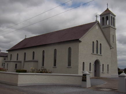 Catholic Church of the Holy FamilyChurch/chapel · 703 yd
 Saint Brendan's Catholic ChurchChurch/chapel · 712 ydTobernagrannHoly well · 1075 ydEnclosure in Grange BegEnclosure · 1.2 mi
 Pallas CastleCastle, tower house · 2.9 miStonyisland BayBay · 7.1 mi
 Friar's IslandIslet · 7.2 miAbbey IslandIslet · 7.4 miCregg PointHeadland · 8.6 mi
 European Yew10 mi
 European Beech10 mi
More archaeology and monuments in County Galway · All of County Galway
What do you know about this place?Tap to add a comment or ask a question