
What is recorded here
From the National Monuments Service (Archaeological Survey of Ireland) record LF013-040
Places near here
Picture notes
- Computer-made picture. It does not show this monument.
- National Inventory of Architectural Heritage
- Computer-made picture. It does not show this playground.
- 瑞丽江的河水, Wikimedia Commons · CC BY-SA 4.0
 Fairy fort / earthen ringfort in MullaghavorneenFairy fort / earthen ringfort · 283 ydComputer-made picture
Explorer Tom Fairy fort / earthen ringfort in Mullaghavorneen reviews visitors as 'too loud' and 'badly dressed'. It was buried under thorns for ages before someone finally cleared it away. Hum something sad nearby, it adds atmosphere.
 Fairy fort / earthen ringfort in FarranyooganFairy fort / earthen ringfort · 576 ydComputer-made picture
Explorer Tom Fairy fort in Farranyoogan took about forty cups of tea to build. Modern sheds destroyed one side because nobody asked permission. It’s half there, half gone, and very confused. Stick around for the light changing, it's a show.
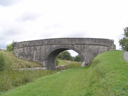 Farranyoogan BridgeBridge · 759 yd
Explorer Tom Farranyoogan Bridge in County Longford would ace a job interview by claiming it's made of pure confidence and granite. It’s basically a stone ego trip from the 1800s that refuses to crack under pressure. Look serious, nod slowly.
 Ecclesiastical enclosure in AghafadEcclesiastical enclosure · 912 ydComputer-made picture
 Incised CrossCross-inscribed pillar · 918 ydComputer-made picture
 IndicatedFairy fort / earthen ringfort · 1128 ydComputer-made picture
Explorer Tom Fairy fort in Farnagh refuses to fall down because it’s too stubborn. It’s divided by a field boundary, which is a bit rude. The wet pasture makes it look like it’s melting. Have a sandwich here and call it a heritage lunch.
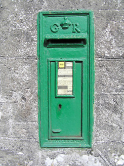 post box1146 yd
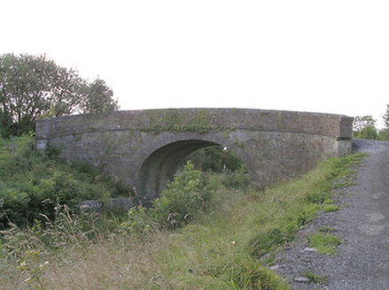 Knockanboy BridgeBridge · 1530 yd
Explorer Tom Knockanboy Bridge in Longford has strict visitor rules: keep your mouth shut and your hands off the masonry, or you’re out. It’s just a sturdy old canal bridge pretending to be a fortress of dignity. Go with someone who loves old stuff.
 Fairy fort / earthen ringfort in FarnaghFairy fort / earthen ringfort · 1595 ydComputer-made picture
Explorer Tom Fairy fort in Farnagh would win a county fair for most effort. It’s been levelled and is basically invisible to the naked eye. I’d bet my boots nobody knows it’s there. Tell the next person you meet it's haunted. It might be.
 Children's playground1602 ydComputer-made picture
 First World War MemorialMemorial · 1.1 mi
 Saint Mel's CathedralCathedral · 1.2 mi
More archaeology and monuments in County Longford · All of County Longford

What do you know about this place?Tap to add a comment or ask a question