What is recorded here
On a low rise in pasture. Depicted as a large subcircular tree-planted enclosure on the 1837 ed. of the OS 6-inch map and as a roughly circular enclosure on the 1914 ed. A report in 1976 (SMR file) recorded that, although levelled, the outline of the perimeter of the monument could still be traced defining a roughly circular area (diam. 45m). Further levelling has since occurred and it is not visible at ground level. Possibly a rath that was subsequently landscaped. O'Donovan
Date of upload: 21 February 2012
On a low rise in pasture. Depicted as a large subcircular tree-planted enclosure on the 1837 ed. of the OS 6-inch map and as a roughly circular enclosure on the 1914 ed. A report in 1976 (SMR file) recorded that, although levelled, the outline of the perimeter of the monument could still be traced defining a roughly circular area (diam. 45m). Further levelling has since occurred and it is not visible at ground…
From the National Monuments Service (Archaeological Survey of Ireland) record LF027-027
The monument record does not grant public access. Check the route and ask the landowner before entering private land.
- What survives
- Recorded monument
Places near here
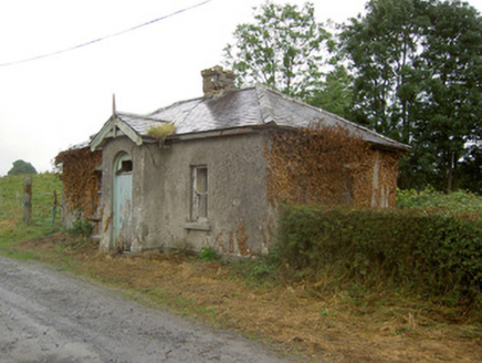 Cartron HouseGate lodge · 263 yd
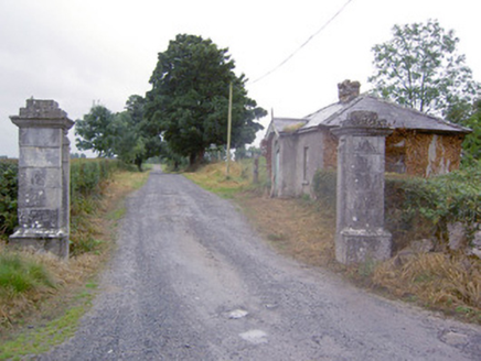 Cartron HouseGates/railings/walls · 274 yd
 European Beech534 ydEnclosure in Rathmore (shrule By.)Enclosure · 793 ydBurial in Creevagh BegBurial · 1207 ydNoughaval CemeteryArchaeological place · 1.3 miCastleCastle, motte · 1.6 miBallymulvey HouseCastle, unclassified · 1.8 miTarget WoodWood · 2.6 miNewcastle WoodsForest · 2.6 mi
 Leveret IslandIslet · 5.0 mi
 Corlea Trackway Interpretative CentreHeritage attraction · 5.6 mi
Pictures: National Inventory of Architectural Heritage; Malene Thyssen, Wikimedia Commons · CC BY-SA 3.0; David Baird, Geograph · CC BY-SA 2.0; Sheila1988, Wikimedia Commons · CC BY-SA 4.0
More archaeology and monuments in County Longford · All of County Longford
What do you know about this place?