What is recorded here
On a SSW-facing slope in pasture with extensive views in all directions. The Inny River is c. 450m to the S. A steep-sided, oval mound of earth and stone (H 4.5-6m; dims. at base c. 24m NE-SW; c. 16m NW-SE) encircled by fragmentary traces of a wide, shallow fosse. A large cavity on the summit (16.5m NE-SW; 12.5m NW-SE) and in the face of the motte at N is the result of quarrying. Traces of an unclassified castle (LF026-013002-) survive at E.
On a SSW-facing slope in pasture with extensive views in all directions. The Inny River is c. 450m to the S. A steep-sided, oval mound of earth and stone (H 4.5-6m; dims. at base c. 24m NE-SW; c. 16m NW-SE) encircled by fragmentary traces of a wide, shallow fosse. A large cavity on the summit (16.5m NE-SW; 12.5m NW-SE) and in the face of the motte at N is the result of quarrying. Traces of an unclassified castle…
From the National Monuments Service (Archaeological Survey of Ireland) record LF026-013001
The monument record does not grant public access. Check the route and ask the landowner before entering private land.
- What survives
- Recorded monument
Places near here
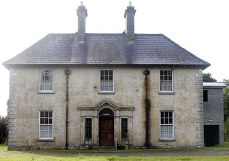 Castlecor HouseHunting/fishing lodge · 104 yd
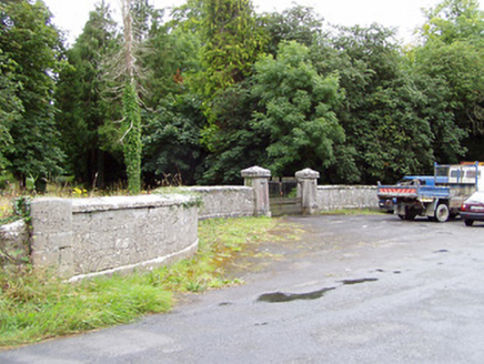 Castlecor HouseGates/railings/walls · 362 yd
 European Beech1.3 mi
 Corlea Trackway Interpretative CentreHeritage attraction · 4.0 mi
 Leveret IslandIslet · 4.4 mi
 RindoonWood · 8.2 mi
 Safe HarbourBay · 8.2 mi
 Rindown CastleCastle, Anglo-Norman masonry castle · 8.2 mi
 Historic town in Warren,rinnaganHistoric town · 8.3 mi
 InchcleraunIsland · 9.1 mi
 Moydrum CastleCastle · 9.7 mi
 Siege of AthloneSiege · 11 mi
Pictures: National Inventory of Architectural Heritage; Malene Thyssen, Wikimedia Commons · CC BY-SA 3.0; Sheila1988, Wikimedia Commons · CC BY-SA 4.0; David Baird, Geograph · CC BY-SA 2.0; Christopher Hilton, Wikimedia Commons · CC BY-SA 2.0; Arno-nl, Wikimedia Commons · CC BY-SA 4.0; Kieran Campbell, Geograph · CC BY-SA 2.0; AndreasDelp, Wikimedia Commons · CC BY-SA 4.0; Wikimedia Commons contributor · CC BY-SA 3.0; Peter Gerken, Wikimedia Commons · CC BY-SA 2.0
More castles and forts in County Longford · All of County Longford
What do you know about this place?