
What is recorded here
Situated on top of a rise, in undulating pasture, with good views to NE and W, obscured to S by a large ridge running E-W. Depicted on the revised 1910 ed. OS 25-inch map as a small roughly circular-shaped feature annotated ‘Cloghstuck’. Monument described in 1979 as no surface remains visible of a standing stone at…
Read the whole record
From the National Monuments Service (Archaeological Survey of Ireland) record WM038-035
Places near here
Picture notes
- Computer-made picture. It does not show this monument.
- National Inventory of Architectural Heritage
- Computer-made picture. It does not show this mountain top.
 Enclosure in Garryduff (newtown Ed)Enclosure · 453 ydTom: I’m here to help · Computer-made picture. It does not show this monument.
Explorer Tom Enclosure in Garryduff has caught my eye in Garryduff (newtown Ed), County Westmeath. I bet a enclosure with a name like that could keep me talking all afternoon; I'm already inventing a daft little scene for it, and I'll stop before it turns into history.
 Saint Hugh's Catholic ChurchChurch/chapel · 539 yd
Explorer Tom Saint Hugh's Catholic Church has caught my eye in Montrath, County Westmeath. I bet a church/chapel with a name like that could keep me talking all afternoon; I'm already inventing a daft little scene for it, and I'll stop before it turns into history.
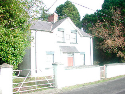 presbytery/parochial/curate's house, building misc553 yd
Explorer Tom Presbytery in Montrath has caught my eye in Montrath, County Westmeath. I bet a presbytery/parochial/curate's house, building misc with a name like that could keep me talking all afternoon; I'm already inventing a daft little scene for it, and I'll stop before it turns into history.
 Fairy fort / earthen ringfort in CappanrushFairy fort / earthen ringfort · 973 ydTom: I’m here to help · Computer-made picture. It does not show this monument.
Explorer Tom Fairy fort / earthen ringfort in Cappanrush has caught my eye in Cappanrush, County Westmeath. I bet a fairy fort / earthen ringfort with a name like that could keep me talking all afternoon; I'm already inventing a daft little scene for it, and I'll stop before it turns into history.
 BarrowBarrow, ring-barrow · 1096 ydTom: I’m here to help · Computer-made picture. It does not show this monument.
Explorer Tom Barrow has caught my eye in Garryduff (newtown Ed), County Westmeath. I bet a barrow, ring-barrow with a name like that could keep me talking all afternoon; I'm already inventing a daft little scene for it, and I'll stop before it turns into history.
 Fairy fort / ringfort in MonassetFairy fort / ringfort · 1709 ydTom: I’m here to help · Computer-made picture. It does not show this monument.
Explorer Tom Fairy fort / ringfort in Monasset has caught my eye in Monasset, County Westmeath. I bet a fairy fort / ringfort with a name like that could keep me talking all afternoon; I'm already inventing a daft little scene for it, and I'll stop before it turns into history.
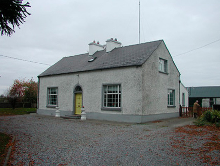 MayvilleHouse · 1717 yd
Explorer Tom Mayville has caught my eye in Montrath, County Westmeath. I bet a house with a name like that could keep me talking all afternoon; I'm already inventing a daft little scene for it, and I'll stop before it turns into history.
 Mound in Kiltober (moycashel By.)Mound · 1.1 miTom: I’m here to help · Computer-made picture. It does not show this monument.
Explorer Tom Mound in Kiltober has caught my eye in Kiltober, County Westmeath. I bet a mound with a name like that could keep me talking all afternoon; I'm already inventing a daft little scene for it, and I'll stop before it turns into history.
 Rahugh MoatArchaeological place · 1.2 miTom: I’m here to help · Computer-made picture. It does not show this monument.
Explorer Tom Rahugh Moat has caught my eye in County Westmeath. I bet a archaeological place with a name like that could keep me talking all afternoon; I'm already inventing a daft little scene for it, and I'll stop before it turns into history.
 StructureStructure, peatland · 1.3 miTom: I’m here to help · Computer-made picture. It does not show this monument.
Explorer Tom Structure has caught my eye in Pallasboy, County Westmeath. I bet a structure, peatland with a name like that could keep me talking all afternoon; I'm already inventing a daft little scene for it, and I'll stop before it turns into history.
Fairy fort / earthen ringfort in AtticonorFairy fort / earthen ringfort · 1.3 miTom: I’m here to help · Computer-made picture. It does not show this monument.Explorer Tom Fairy fort / earthen ringfort in Atticonor has caught my eye in Atticonor, County Westmeath. I bet a fairy fort / earthen ringfort with a name like that could keep me talking all afternoon; I'm already inventing a daft little scene for it, and I'll stop before it turns into history.
 Mullagharush HillMountain / peak · 1.8 miTom: I’m here to help · Computer-made picture. It does not show this mountain top.
Explorer Tom Mullagharush Hill has caught my eye in County Offaly. I bet a mountain / peak with a name like that could keep me talking all afternoon; I'm already inventing a daft little scene for it, and I'll stop before it turns into history.
More archaeology and monuments in County Westmeath · All of County Westmeath

What do you know about this place?Tap to add a comment or ask a question