
Places near here
Photo credits
- National Inventory of Architectural Heritage
- Trenchspike, Wikimedia Commons · CC BY-SA 4.0
- kevin higgins, Wikimedia Commons · CC BY-SA 2.0
- Dalenevada, Wikimedia Commons · CC BY-SA 4.0
- Mike Searle, Geograph · CC BY-SA 2.0
- JP, Geograph · CC BY-SA 2.0
- Willow, Wikimedia Commons · CC BY 2.5
- Algirdas at Lithuanian Wikipedia, Wikimedia Commons · Public domain
Explorer Tom Kiltober Castle makes a weird creaking sound at night that sounds like it's trying to remember how to be a building. It was removed twenty years ago but somehow still lingers in the grass, like a ghost who can't commit to leaving. Get there early and have it all to yourself.
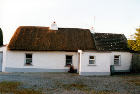 farm house1635 yd
 Lowertown BridgeBridge · 1647 yd
Explorer Tom Lowertown Bridge is suspicious of the postman because he keeps walking on its back without asking permission, which is a real lack of manners for a canal bridge. It’s all stone masonry and functional elegance, but I think it secretly wants to be a boat instead. Sketch that simple form!
Bonfire HillMountain / peak · 1.7 miExplorer Tom Bonfire Hill’s family tree consists entirely of other hills that also wanted to catch fire but didn’t manage it. Its name suggests it used to be a party, but now it’s just a very smoky hill. Dare you to say hello to it out loud.
Lackan HillMountain / peak · 2.0 mi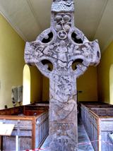 St. Columbkilles CrossCross, High cross · 4.0 mi
Explorer Tom St. Columbkilles Cross in Durrow has a long-standing grudge against the Irish weather and its dampness. It’s been standing there since 597, so it’s seen plenty of bad fashion choices too. Have a sandwich here and call it a heritage lunch.
 Durrow High CrossVisitor attraction · 4.0 mi
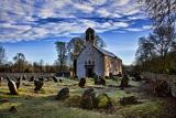 CrossCross, High cross · 4.0 mi
Explorer Tom Cross in Durrow Demesne is just a shaft fragment cemented into the wall like it’s giving up. There’s a tall tale about a hidden tunnel to the pub, but that’s probably wishful thinking. Stick around for the light changing, it's a show.
 Durrow MoatCastle, motte · 4.1 mi
Explorer Tom Durrow Moat is deeply suspicious of the postman and hides its head under the earth. Hugh de Lacy died there, so don't get too comfortable. Tell it a joke, it's been a long time since anyone did.
 Grand Canal WayWalking route · 4.6 mi
 European ash5.2 mi
Explorer Tom This European ash in County Offaly is hiding a scandal about which branch grew first, and nobody agrees. It keeps the truth locked up tight while the leaves rustle with gossip. Go back in winter, it's a different animal when it’s all bare and honest.
 Pedunculate Oak6.2 mi
More archaeology and monuments in County Westmeath · All of County Westmeath

What do you know about this place?Tap to add a comment or ask a question