
What is recorded here
From the National Monuments Service (Archaeological Survey of Ireland) record MA068-005
Places near here
Photo credits
- Maker not stated on source page, au.pinterest.com
- Maker not stated on source page, www.alamy.com
- National Inventory of Architectural Heritage
- Maker not stated on source page, www.gettyimages.ca
- Colin Park, Geograph · CC BY-SA 2.0
- Maker not stated on source page, www.pinterest.com
- John Moylette / Western People, www.westernpeople.ie
 Coarse IslandIslet · 636 yd
Explorer Tom Coarse Island would complain to the council that its name is too literal for a tourist destination. It’s got that…
 Annagh CemeteryCemetery · 1581 yd
Explorer Tom Annagh Cemetery in County Mayo is where the seagulls go to complain about everything, from the wind to your choice of…
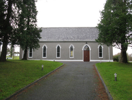 Saint Joseph's Catholic ChurchChurch/chapel · 1.1 mi
Explorer Tom Saint Joseph’s Church in Gortnaheltia would buy a giant lottery ticket and spend it all on paint. Built after the 1829…
 Glenisland Garda Síochána StationGarda station/constabulary barracks · 1.2 mi
Explorer Tom Glenisland Garda Station is built from ruby-coloured sandstone, which makes it look like a big red gem! It’s got an…
 Grouse LodgeHunting/fishing lodge · 1.5 mi
Explorer Tom Grouse Lodge is perched there with its back to Croaghmoyle Mountain, probably plotting something. It was built for…
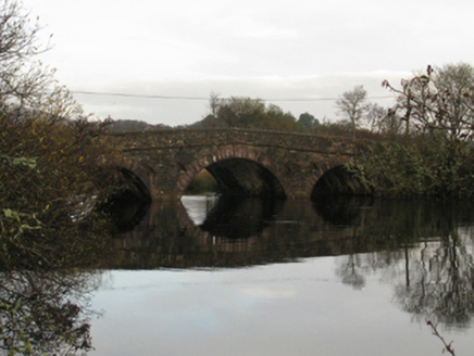 Crumpaun BridgeBridge · 1.5 mi
Explorer Tom Crumpaun Bridge was the site where a priest lost a bet about how high he could jump. The sandstone dressings are…
 Glenisland GraveyardCemetery · 1.8 mi
Explorer Tom Glenisland Graveyard in County Mayo would be filing a complaint with the council about the lack of proper drainage.…
 Catholic Church of the Holy RosaryChurch/chapel · 2.1 mi
Explorer Tom Catholic Church of the Holy Rosary has an imaginary fan club that meets every Tuesday to critique its skewed axis. It…
 farm house2.1 mi
Explorer Tom Farm house in Barnastang has an outshot that looks like it’s trying to hug the wall, and the windows are tiny compared…
 Birreencorragh South TopMountain / peak · 3.8 mi
Explorer Tom Birreencorragh South Top is the backup singer for the main peak, standing slightly lower but trying really hard to look…
 CastleCastle, unclassified · 5.1 mi
Explorer Tom Castle in Carrickaneady is complaining to the council about how no one visits it anymore, which is a bit rich given its…
 McGovern Park, Newport, Burrishoole GAAGAA ground · 5.4 mi
More archaeology and monuments in County Mayo · All of County Mayo

What do you know about this place?Tap to add a comment or ask a question