What is recorded here
Situated at the crest of a S-facing slope. The church of Kilcashel (WX002-001001-) is within a large enclsoure (dims c. 140m NW-SE; c. 70m NE-SW defined by a stone wall WNW-NE with an earthen bank and townland boundary with Wingfield NE-SE and modern walls elsewhere. The rath (WX002-001003-) is inside the perimeter at N, and mound (WX002-055----) is within it at SE.
From the National Monuments Service (Archaeological Survey of Ireland) record WX002-001004
The monument record does not grant public access. Check the route and ask the landowner before entering private land.
- What survives
- Recorded monument
Places near here
Photo credits
- National Inventory of Architectural Heritage
- Sarah777 at English Wikipedia, Wikimedia Commons · Public domain
- Jonathan Billinger, Wikimedia Commons · CC BY-SA 2.0
- Maker named on the Wikimedia Commons picture page · CC BY-SA 2.5
- Miguel Angel Masegosa Martínez, Wikimedia Commons · CC BY 2.0
Site of Kilcashel ChurchChurch · 42 yd1798 MemorialMemorial · 260 yd Barnadown HouseGates/railings/walls · 595 ydWingfield HouseFarm house · 605 ydIndicatedEnclosure · 1324 yd(Site of) Raymond CastleCastle, unclassified · 1.7 miAnnagh HillMountain / peak · 2.0 miMonalee HillMountain / peak · 2.7 mi1798 Lacey Brothers MemorialMemorial · 3.3 mi(Site of) Castle & RampartCastle, unclassified · 3.5 miSessile Oak3.7 miSweet Chestnut4.3 mi
 Barnadown HouseGates/railings/walls · 595 yd
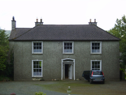 Wingfield HouseFarm house · 605 ydIndicatedEnclosure · 1324 yd(Site of) Raymond CastleCastle, unclassified · 1.7 mi
 Annagh HillMountain / peak · 2.0 mi
 Monalee HillMountain / peak · 2.7 mi1798 Lacey Brothers MemorialMemorial · 3.3 mi(Site of) Castle & RampartCastle, unclassified · 3.5 mi
 Sessile Oak3.7 mi
 Sweet Chestnut4.3 mi
More archaeology and monuments in County Wexford · All of County Wexford
What do you know about this place?