What is recorded here
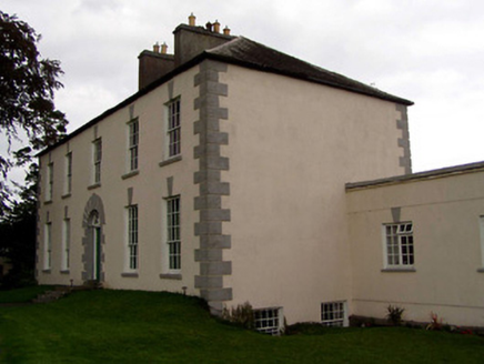
Situated on an E-facing slope in undulating pasture. A circular area (diam. 22.8m N-S; 21.4m E-W; H 0.68m) surrounded by a fosse (Wth 3.8m; D 0.7m) and outer bank (Wth 3.5m; ext. H 0.75m). A large conglomerate boulder lies on the central mound at SW partially resting on small stones. It may have been dumped here, but is certainly there as long as the landowner remembers. The outer bank is planted with larch trees and it is likely that the site was reused as a tree-ring for Bantis House which is located to the NE. Vol. 1 - North Tipperary' compiled by Jean Farrelly and Caimin O'Brien (Dublin: Stationery Office, 2002).
From the National Monuments Service (Archaeological Survey of Ireland) record TN015-104
Places near here
Photo credits
- National Inventory of Architectural Heritage
- Mike Searle, Wikimedia Commons · CC BY-SA 2.0
- David P Howard, Geograph · Creative Commons Attribution-ShareAlike 2.0
 Glenahilty National SchoolSchool · 861 yd
 CastleCastle, tower house · 1233 ydBallycapple WoodForest · 1685 ydEnclosure in MiddlewalkEnclosure · 1.0 mi
 Coolnamunna HouseCountry house · 1.4 miThomas MacDonagh Heritage CentreMuseum · 2.4 miMacDonagh HouseMemorial · 2.4 miJames Devaney MemorialMemorial · 2.8 miKnockanacree WoodForest · 3.3 mi
 Knockane CastleCastle · 4.1 miOld BarracksHeritage attraction · 5.9 mi
 Church (in Ruins)Graveyard · 6.2 mi
More archaeology and monuments in County Tipperary · All of County Tipperary
What do you know about this place?Tap to add a comment or ask a question