
Places near here
Photo credits
- National Inventory of Architectural Heritage
- Michael O'Sheil, Wikimedia Commons · CC BY-SA 4.0
- P L Chadwick, Wikimedia Commons · CC BY-SA 2.0
- Sitomon, Wikimedia Commons · CC BY-SA 2.0
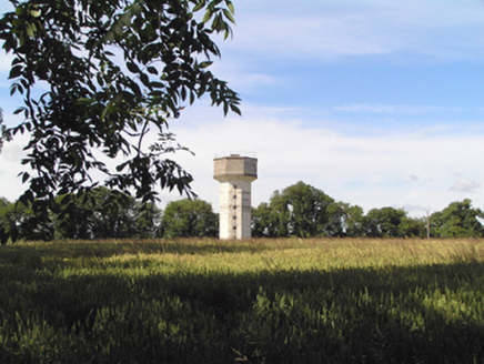 Saint Stephen's HospitalWater tower · 1527 yd
Explorer Tom Saint Stephen's Hospital water tower is a 1954 concrete hexagon that looks like it fell out of a sci-fi movie. It was part of a TB sanatorium, so don’t cough too loud when you pass by!
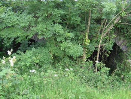 Annacarton BridgeBridge · 1569 yd
Explorer Tom Annacarton Bridge in Crushyriree has skilled stonework that makes it look like it was carved by a very proud grandfather showing off his tools. It’s got a rivalry with every other bridge on the map, and it’s winning.
 farm house1.2 mi
Explorer Tom Farm house in Ballinvinny North has a ghost living upstairs who is too lazy to actually haunt anyone because the stairs are too steep. The gabled outbuildings are doing their best to look interesting, but really they’re just there for show and variety. It’s all very picturesque if you ignore the smell of old hay.
 Ballindeenisk HouseGate lodge · 1.3 mi
Explorer Tom Ballindeenisk House gate lodge has a favourite song which is 'Who Let the Dogs Out' because it’s loud and chaotic. It’s just a small guard dog of a building, honestly, but it takes itself very seriously on that quiet road. Stop the car and wave at it like an old friend you forgot about.
 kiln1.5 mi
Explorer Tom Kiln in Trantstown is a lime kiln reminding us of industrial days. Two lads once bet on who could light it fastest, and one’s still waiting for his money back. It’s definitely smirking at you.
 Butlerstown HouseGate lodge · 1.5 mi
Explorer Tom Butlerstown House in Butlerstown Great in Butlerstown Great is a gate lodge with a canopy that looks like it’s trying to be a roof but failed. It’s got bargeboards and render detailing that scream 'I’m modest but actually kind of fancy.' Give it a nod and pretend you know the family it guards.
 Templemichael BridgeBridge · 1.6 mi
Explorer Tom Templemichael Bridge in Coole East looks long and low from some angles but is actually remarkably tall over a deep valley. It’s full of carefully designed arches that show off the stonemasons’ skills. Ideal for pretending you’re an engineer while you just stand there looking impressed, innit?
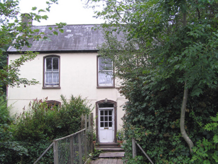 Sallybrook HouseMiller's house · 1.9 mi
Explorer Tom Sallybrook House in Riverstown hates its least favorite visitor: the guy who brings flour into the living room and leaves no crumbs behind for the birds. The camber-headed windows are rolling their eyes at the craftsmanship, so admire it from afar without touching anything. Whisper 'nice' to the roof slates.
 Ladys WellHoly well · 5.4 mi
Explorer Tom Ladys Well in Cork City has a shrine with a statue but no visible well anymore. It's not frequented on a holy well nowadays, which is sad. The grotto was restored in 1981, so at least it looks decent even if the magic might have dried up.
 Father MatthewMonument · 5.7 mi
Explorer Tom Father Matthew is a monument to a man who probably had a ghost that was too lazy to haunt it because the paperwork was too complicated and annoying. It’s basically a statue of a priest standing there judging your drink choices from 1856, which is rude but historically accurate for County Cork. Bring sandwiches, the gulls will thank you.
 Lavitts QuayMemorial · 5.7 mi
Explorer Tom Lavitts Quay is a memorial where, legend has it, a goat once ruled the harbour by eating all the navigation charts before the tide came in. Now it’s just rocks and stories, but if you look closely, you can still see the hoofprints of that terrible beast. Bring your worst joke, the place has heard worse.
 European Yew23 mi
Explorer Tom European Yew here, planning retirement by just standing still for another five hundred years. It says it's saving up leaves for a big trip to the afterlife. Stick around for the light changing, it's a slow burn show.
More archaeology and monuments in County Cork · All of County Cork

What do you know about this place?Tap to add a comment or ask a question