What is recorded here
In disused farm yard. According to Barry (1890, 517) 'the rath at Ballyknock was of large dimensions, and had three encircling ramparts'. Remains consist of subcircular area (diam. c. 45m) enclosed by stone-faced earthen bank (int. H 1.7m) from E->NNW with internal fosse from SW->NNW. Interior slightly raised; overgrown; has many felled trees. Stream flows inside bank in SE quadrant. Disused farm buildings and stone walls in N side of interior. Barry states that in 1890 'one-fourth of the middle rampart and nearly all the inner fosse remain' while 'another fourth of the middle rampart and a remnant of the outer rampart were erased by the late Mr. Donovan about twenty years ago'. Man-made underground passage (CO055-007003-) in NW quadrant; site of castle (CO055-007004-) in interior.
The above description is derived from the published 'Archaeological Inventory of County Cork. Volume 2: East and South Cork' (Dublin: Stationery Office, 1994). In certain instances the entries have been revised and updated in the light of recent research.
Date of upload/revision: 14 January 2009
The monument record does not grant public access. Check the route and ask the landowner before entering private land.
- What survives
- Recorded monument
Places near here
 Ballyknock Castle (Site of)Castle, unclassified · 12 yd
 Ogham StonesOgham stone · 39 yd
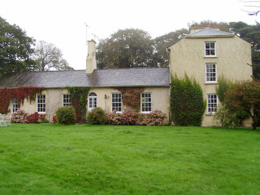 Newtown Lodgehouse · 886 yd
 Salt HillMountain / peak · 920 yd
 Historic buildingOfficially recorded historic building · 1111 yd
 TobereenkilgraniaHoly well · 1758 yd
 Leahy's Open FarmHeritage attraction · 1.8 mi
 Graveyard in KillasseraghGraveyard · 2.2 mi
 Clonmult Ambush SiteBattlefield · 3.6 mi
 Castlebrook forestWood · 3.9 mi
 Graveyard in Curraheen (kinnatalloon By.)Graveyard · 4.0 mi
 Conna CastleCastle · 4.2 mi