
Places near here
Photo credits
- National Inventory of Architectural Heritage
- Paul Mc Carthy, Geograph · Creative Commons Attribution-ShareAlike 2.0
- Willow, Wikimedia Commons · CC BY 2.5
- Mike Searle, Geograph · CC BY-SA 2.0
- Ronnie Nijboer, Wikimedia Commons · CC0
- Jamie Carroll, Wikimedia Commons · CC BY-SA 2.0
- Mike Searle, Wikimedia Commons · CC BY-SA 2.0
Explorer Tom Enclosure in Ballycarn nearly got famous when someone mistook it for a giant cat enclosure online. It was a bit embarrassing, but it still looks like a pet home. Ten minutes here and you'll have a yarn for the pub later.
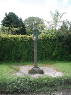 water pump1278 yd
Explorer Tom Water pump in Cloncurry is still pumping out gossip about that bishop who refused to visit. He probably just didn't want to get his fancy shoes wet. Stand where the owner stood and nod respectfully.
 Grave YardGraveyard · 1303 yd
Explorer Tom Graveyard in Cloncurry nearly got famous when someone tried to digitize its records in the nineties, but the internet was too slow. It sits right next to a motte, looking like a very serious neighbor. If anyone asks, Tom sent you.
 European ash1313 yd
Explorer Tom This ash smells like old books and regret, according to my very scientific nose. It’s the kind of tree that remembers every time you sneezed in its direction. Stand where the owner stood and practise looking smug about your knowledge.
Cloncurry GraveyardHeritage attraction · 1320 ydExplorer Tom Cloncurry Graveyard in County Kildare is where the seagulls probably have their weekly gossip sessions about who’s sleeping with whom underground. It’s a heritage attraction that definitely knows its own mind and doesn't need your opinion on the layout. Dare you to say hello to it out loud.
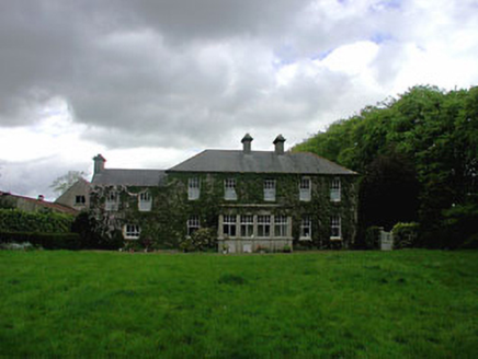 Ballyvoneen HouseHouse · 1350 yd
Explorer Tom Ballyvoneen House got burnt down in 1798 and came back angrier, which explains the complex look of it all. If it won lotto, it would probably just buy more walls to hide behind. Hang around long enough and you'll hear it sigh.
Old Bog Road made famous by Teresa Bryton 1868-1943Memorial · 2.0 miExplorer Tom Teresa Bryton allegedly once dropped her tea on this road and the steam rose so high it touched the clouds. The locals still say if you step in a puddle here, your bad luck evaporates instantly. Snap one photo, then put the phone away and actually look.
 Bawn in Newcastle (moyfenrath Lower By.)Bawn · 2.4 mi
Explorer Tom Bawn in Newcastle is actually a fancy word for a wall that forgot how to hold itself together properly. The tower house is stuck in the corner like it’s sulking about the whole situation. Make up your own legend and I'll swear it's true.
 Wych Elm4.5 mi9/11 MemorialMemorial · 5.1 mi
Explorer Tom The 9/11 Memorial hears the sound of jet engines in its dreams and finds them slightly annoying. It’s got a serious vibe, like it’s waiting for an apology that will never come from New York. Tell the next person you meet it's haunted, because it might actually be.
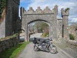 Donadea Forest ParkVisitor information · 5.3 mi
Explorer Tom Donadea Forest Park was nearly sold for the price of a horse when nobody could agree on what ‘heritage’ actually meant in 1974. Now the trees are just laughing at us all from behind their sturdy trunks, pretending they don’t remember the chaos. Take the long way round, it deserves the effort.
_-_geograph.org.uk_-_2494096.jpg/250px-Castles_of_Leinster,_Donadea,_Kildare_(1)_-_geograph.org.uk_-_2494096.jpg "Photo: Mike Searle, Wikimedia Commons · CC BY-SA 2.0") Donadea CastleCastle, tower house · 5.3 mi
Donadea CastleCastle, tower house · 5.3 miExplorer Tom Donadea Castle would order fish and chips with extra ketchup at any chipper. It’s a Birmingham manor that ended up in a forest park somewhere in Kildare. A good place to forget your phone for ten minutes.
More archaeology and monuments in County Meath · All of County Meath

What do you know about this place?Tap to add a comment or ask a question