Places near here
Photo credits
- National Inventory of Architectural Heritage
- Irishrover1980, Wikimedia Commons · CC BY-SA 4.0
- Sitomon, Wikimedia Commons · CC BY-SA 2.0
- Willow, Wikimedia Commons · CC BY 2.5
- AmandaMcCrann, Wikimedia Commons · CC BY-SA 4.0
- Sarah777 at en.wikipedia, Wikimedia Commons · Public domain
- Mike Searle, Geograph · CC BY-SA 2.0
- Mike Searle, Wikimedia Commons · CC BY-SA 2.0
- AndreasDelp, Wikimedia Commons · CC BY-SA 4.0
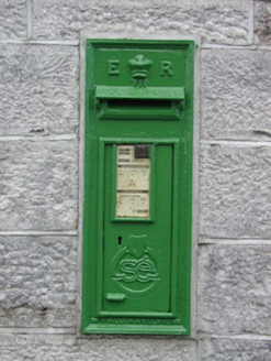 post box1365 yd
Explorer Tom Post box in Cams in Cloverhill witnessed a love story that went badly wrong next to it. They argued over whether it was red or green, and now neither will speak! It’s got a mix of nineteenth-century charm and early twentieth-century grit. Drop a letter in for your ex.
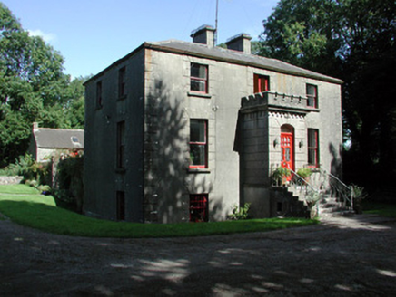 Fortview HouseHouse · 1.7 mi
Explorer Tom Fortview House in Mullymucks had its most dramatic moment when a pigeon landed on its crenellated porch and acted like it owned the whole place. It’s hidden behind evergreens so well that even the mailman is confused, which makes for a great mystery to solve. If you spot the gate piers, wave; the house is probably hiding from the sun.
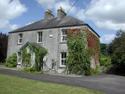 Castleview HouseHouse · 2.2 mi
Explorer Tom Castleview House in Cloonybeirne gets its name from staring at a ruined castle like it’s an ex-partner. The local sheep have opinions on this, mostly that the view is overrated and the grass behind the house is better. It’s got original doors, which means it hasn't changed its mind about anything in decades.
 Roscommon CastleCastle · 2.2 mi
Explorer Tom Roscommon Castle in County Roscommon would explain the 1800s to a teenager by saying, 'Imagine your mum's house, but with more damp and fewer Wi-Fi signals.' It’s been sitting there judging everyone since before we had proper trousers, still looking mighty smug about it. Go now, before it gets famous.
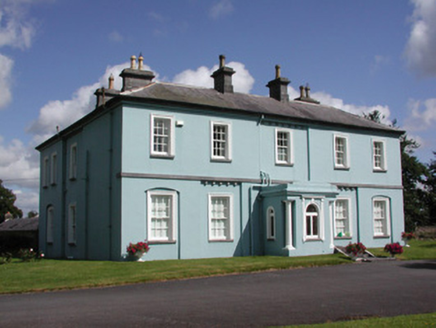 Essex Lawn HouseHouse · 2.4 mi
Explorer Tom Essex Lawn House in Cloonybeirne has a bitter feud with the rain that has been going on for about two hundred years and showing no signs of stopping. It stands there with its dentil detailing looking like it’s judging your umbrella choice, which is probably wrong anyway. Ideal spot to watch the clouds fight; the house takes notes on every drop.
 European Yew3.1 mi
Explorer Tom European Yew in County Roscommon had a cow try to buy it once, which is either genius or absolute madness. The tree just stood there looking unimpressed while the farmer argued about the price of such an ancient specimen. Bring a jacket, it's never as warm as I promise.
 European ash3.1 mi
Explorer Tom European ash in County Roscommon would have given Saint Patrick a real headache if he’d tried to move it out of Ireland. It’s just standing there with its big leaves, acting like it hasn't got a single disease problem at all. A good place to forget your phone for ten minutes.
 IndicatedRound tower · 4.3 mi
Explorer Tom Round tower in Carroweighter is constantly losing a rivalry with the ones in Kildare, which are way too showy for their own good. It stands there with its arms crossed, pretending it doesn’t care that everyone else gets the tourists. Count the crows, then count them again to be sure.
 Stone sculptureStone sculpture, aniconic · 4.5 mi
Explorer Tom Standing stone in Castleteheen is tiny and lost inside a rath, wondering why the Vikings didn’t find it sooner. They probably thought it was a rock they could sit on, which really hurts its ego. Snap one photo, then put the phone away and actually look.
 CastleHouse, fortified house · 5.0 mi
Explorer Tom Castle in Toberavaddy holds the fake world record for the most awkward L-shaped architecture ever attempted. Edward Ormsby owned it, but I doubt he knew what to do with all that extra corner. Tell it a joke, it's been a long time since anyone did.
_-_geograph.org.uk_-_1952978.jpg/250px-Castles_of_Connacht,_Glinsk,_Galway_(2)_-_geograph.org.uk_-_1952978.jpg "Photo: Mike Searle, Wikimedia Commons · CC BY-SA 2.0") Bawn in Glinsk (ballymoe By.)Bawn · 7.8 mi
Bawn in Glinsk (ballymoe By.)Bawn · 7.8 miExplorer Tom Bawn in Glinsk listens to what goes on inside the walls and probably hears the Burkes arguing about who left the light on in 1630. It’s a well-preserved semi-fortified house that looks like it’s judging your posture, so stand up straight or don’t bother knocking. It's free, it's odd, what more do you want?
 InchcleraunIsland · 10 mi
Explorer Tom Inchcleraun has two names, a monastery and enough legend to keep me talking well beyond the boat ride. It lies in Lough Ree between Roscommon and Longford, covering about fifty-eight hectares. Saint Diarmaid's community was founded around 560, leaving ruins now protected as a national monument. The Irish name points to Clothru, a queen in story, and Maeve also gets a chapter in the island's folklore. I would settle their argument over who owned the best view, but it is wiser to separate tales from surviving stone. There is no road across the lake; arrange a permitted boat, confirm landing and return, and respect the old religious ground. Look back at both shores once you arrive. The island sits between counties and between several very different kinds of history.
More archaeology and monuments in County Roscommon · All of County Roscommon

What do you know about this place?Tap to add a comment or ask a question