What is recorded here
In level pasture, in the demesne of Shannongrove House (LI003-028----). A roughly circular mound (H. c. 4m), masked by dense vegetation overgrowth, is apparent in a waterfilled area. Access to the mound was not gained due to the depth of water surrounding it.
From the National Monuments Service (Archaeological Survey of Ireland) record LI003-032
The monument record does not grant public access. Check the route and ask the landowner before entering private land.
- What survives
- Recorded monument
Places near here
Photo credits
- Miguel Angel Masegosa Martínez, Wikimedia Commons · CC BY 2.0
- National Inventory of Architectural Heritage
- Garry Dickinson, Wikimedia Commons · CC BY-SA 2.0
- Liam, Geograph · CC BY-SA 2.0
- Joseph Mischyshyn, Geograph · Creative Commons Attribution-ShareAlike 2.0
- Dieglop, Wikimedia Commons · CC BY-SA 4.0
- Jon Sullivan, Wikimedia Commons · Public domain
- Greg and Cindy, Wikimedia Commons · CC BY 2.0
 Sweet Chestnut199 ydSweet Chestnut230 yd
 Shannongrove HouseCountry house · 384 ydIndicatedEnclosure · 729 yd
 Dromaher HouseHouse · 810 ydRingmoylan PierVisitor information · 1.0 mi
_-_geograph.org.uk_-_6538081.jpg/250px-Castles_of_Munster,_Shanpallas,_Limerick_(1)_-_geograph.org.uk_-_6538081.jpg "Photo: Garry Dickinson, Wikimedia Commons · CC BY-SA 2.0") Shanpallas CastleCastle · 1.4 mi
Shanpallas CastleCastle · 1.4 mi Castle (in ruins)Castle, tower house · 1.4 mi
 Graveyard3.3 mi
 Bunratty CastleHouse · 3.3 mi
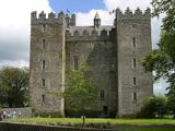 Bunratty CastleCastle · 3.4 mi
 Pan Am Flight 1-10Aviation accident · 4.3 mi
More archaeology and monuments in County Limerick · All of County Limerick
What do you know about this place?