What is recorded here
In pasture, on low-lying marshy terrain. Depicted on 1841 and later OS 6-inch maps as distinct curve in field boundary. Semi-circular area (diam. c. 135m N-S) enclosed by earthen bank (int. H 0.4m; ext. H 1.2m) N->S with external fosse (Wth 1m; D 0.6m) N->SE. Field boundary cuts across interior on rough E-W axis to abut inner bank face at SE. Interior, under pasture, forms part of adjoining fields. Field boundary abuts external bank face at E.
In pasture, on low-lying marshy terrain. Depicted on 1841 and later OS 6-inch maps as distinct curve in field boundary. Semi-circular area (diam. c. 135m N-S) enclosed by earthen bank (int. H 0.4m; ext. H 1.2m) N->S with external fosse (Wth 1m; D 0.6m) N->SE. Field boundary cuts across interior on rough E-W axis to abut inner bank face at SE. Interior, under pasture, forms part of adjoining fields. Field boundary…
From the National Monuments Service (Archaeological Survey of Ireland) record LI003-025
The monument record does not grant public access. Check the route and ask the landowner before entering private land.
- What survives
- Recorded monument
Places near here
Photo credits
- National Inventory of Architectural Heritage
- Miguel Angel Masegosa Martínez, Wikimedia Commons · CC BY 2.0
- Garry Dickinson, Wikimedia Commons · CC BY-SA 2.0
- Liam, Geograph · CC BY-SA 2.0
- Dieglop, Wikimedia Commons · CC BY-SA 4.0
- Joseph Mischyshyn, Geograph · Creative Commons Attribution-ShareAlike 2.0
- Jon Sullivan, Wikimedia Commons · Public domain
- Greg and Cindy, Wikimedia Commons · CC BY 2.0
IndicatedEnclosure · 621 yd Coláiste SailíseachCountry house, church/chapel · 763 ydSweet Chestnut842 ydSweet Chestnut880 ydShannongrove HouseCountry house · 1090 ydShanpallas CastleCastle · 1724 ydCastle (in ruins)Castle, tower house · 1743 ydRingmoylan PierVisitor information · 1.5 miBunratty CastleHouse · 3.4 miGraveyard3.4 miBunratty CastleCastle · 3.5 miPan Am Flight 1-10Aviation accident · 4.7 mi
 Coláiste SailíseachCountry house, church/chapel · 763 yd
 Sweet Chestnut842 ydSweet Chestnut880 yd
 Shannongrove HouseCountry house · 1090 yd
_-_geograph.org.uk_-_6538081.jpg/250px-Castles_of_Munster,_Shanpallas,_Limerick_(1)_-_geograph.org.uk_-_6538081.jpg "Photo: Garry Dickinson, Wikimedia Commons · CC BY-SA 2.0") Shanpallas CastleCastle · 1724 yd
Shanpallas CastleCastle · 1724 yd Castle (in ruins)Castle, tower house · 1743 ydRingmoylan PierVisitor information · 1.5 mi
 Bunratty CastleHouse · 3.4 mi
 Graveyard3.4 mi
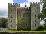 Bunratty CastleCastle · 3.5 mi
 Pan Am Flight 1-10Aviation accident · 4.7 mi
More archaeology and monuments in County Limerick · All of County Limerick
What do you know about this place?