What is recorded here
House, fortified house in Tirlickeen stands in elevated pasture with good views in all directions. In 1620 Connell McIrriell Ferrall received Tirlickeen during the Crown plantation of Longford, and later writers recorded stone walls, gardens and improvement. The ancient house near Ballymahon has faded until only a low wall and outbuilding footings remain, inviting wonder about the people who lived, worked and disappeared there.
In elevated pasture, with good views in all directions. In 1620 Connell McIrriell Ferrall was granted the lands of Tirlickeen as part of the Crown plantation of Longford (Cal. pat. rolls Jas I, 468). Described in the Civil Survey (1654-6) as ‘a stone house well repaired’ (Simington 1961, vol. 10, 48) and mentioned in the 1641 depositions as belonging to 'John Farrell', who along with others, 'had taken up his castle [LF022-072001-]; Great house & houses off office within the Bawen [LF022-072002-]' at Tirlickeen (TCD MS 817, fol. 277v). In 1682 Nicholas Dowdall noted that 'Sir Connell Ferrall Knight hath wrought much improvement', and he also refers to 'Inclosures Orchds Gardens [LF022-072003-]' (Gillespie and Moran 1991, 211). Shaw-Mason (1819, vol. 3, 339), when referring to the later 18th-century house (since levelled) built by Lord Annaly, c. 850m to the NW and named ‘Tirlickeen House’ on the OS 6-inch maps, notes that 'the ancient house was somewhat nearer to Ballymahon, and is now in ruins'. No visible surface trace of the house survives within the bawn (LF022-072002-) and its precise location has not been identified. It may have been located in the adjoining bawn to the S. Three buildings, possibly a house and two outbuildings, are depicted within it on the 1836 edition of the OS 6-inch map. The house was orientated NW-SE. Only its NE wall (L c. 30m; H 0.7m wall T 0.7m) survives but no architectural features are visible. The wall-footings of the N outbuilding (6.1m E-W; 5.1m N-S; Wall T 0.65m), orientated E-W, are evident. No visible surface trace of the outbuilding to its SW survives. These buildings may have been built on the site of the house or the house may have been incorporated into one of them.
Compiled by: Caimin O'Brien
Date of upload: 18 June 2012
Connell McIrriell Ferrall was granted the lands of Tirlickeen in 1620 as part of the Crown plantation of Longford under James I. The fortified house is remembered as a symbol of early 17th-century colonial settlement and land redistribution in Ireland.
The monument record does not grant public access. Check the route and ask the landowner before entering private land.
- What survives
- Recorded monument
Places near here
 Tober PatrickHoly well · 487 yd
 Bawn in TirlickeenBawn · 524 yd
 Pake Bridgebridge · 604 yd
 Enclosure in MullaworniaEnclosure · 869 yd
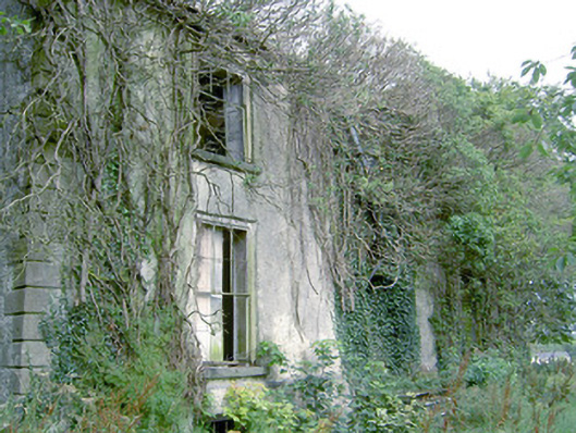 Lismacmurrough Househouse · 1225 yd
 Barry CastleCastle, unclassified · 1.7 mi
 Corlea Bog Walk Canal BranchWalking route · 2.4 mi
 Corlea Trackway Interpretative CentreHeritage attraction · 2.6 mi
 Corlea Bog Walk Blue LoopWalking route · 2.9 mi
 Leveret IslandIslet · 5.1 mi
 InchbofinIslet · 6.0 mi
 Graveyard in Curry (ardagh By., Coolamber Ed)Graveyard · 7.1 mi