What is recorded here
Associated with a 17th-century house (LF022-072001-). The 1641 depositions state that John Farrell, along with others, ‘had taken up his castle [LF022-072001-]; Great house [LF022-072----] & houses off office within the Bawen’ at Tirlickeen (TCD MS 817, fol. 277v). This subrectanular bawn (32.8m E-W; 31m N-S) is enclosed by a roughly coursed, rubble-built wall (H 0.2m-1.9m; T 0.7m) with an external fosse (Wth 2m-4.5m; ext. D 0.5m) that was water-filled at the time of visit. The wall is best preserved at the E angle and along the SE side. Only the wall-footings of the SW, NW and NE sides survive. A single upright stone on the W side of a wide gap (Wth 3.5m) in the SE wall may mark a possible gateway. A two-storey high, circular angle tower (int. diam. 3.6m; wall T 0.75m; H 3.5-4m) on the W corner is built with roughly coursed rubble and is rendered externally with lime. There is no base-batter. Access to the tower is through a broken-out doorway (Wth 1.2m) at SE. Two blocked-up slit opes or gun loops, set into flat-headed embrasures (H 0.9m; Wth 0.45m), are visible directly opposite each other just inside the doorway at NE and SW. They provided flanking fire along the external faces of the N and W walls of the bawn. Two recesses in the internal face at S may have been for supports of a timber stairs, which would have accessed the first floor. There is no evidence of any joist-holes or an offset for this floor level, which was lit by three flat-headed rectangular windows (H 1.05m; Wth 0.68m) at SW, W and N. The windows at SW and N are blocked up. A small wall cupboard (H 0.6m; Wth 0.4m) is also visible at NW. Within the interior of the bawn the wall-footings of a building (c. 9.8m E-W; 4m N-S), orientated E-W, that is depicted on the 1836 edition of the OS 6-inch map are evident at E. There are no visible surface traces of the 17th-century house; it may have been located in the adjoining bawn to the SE. The latter irregularly shaped area (c. 72m E-W; 60m N-S) is defined by a roughly coursed rubble wall (T 0.7m), which is similar to the bawn wall and may be contemporary with it, and an external fosse (Wth 3m; ext. D 0.3m). It walls are now mostly levelled, only the wall-footings of the E and W walls survive, while the external fosse or moat is all that survives on the S side. A cobbled roadway runs through its S end. Another rubble-built wall (H 0.6m; T 0.7m), again similar in construction to the bawn wall, runs off the N side of the angle tower, it may be associated with the gardens or orchards of the house – see LF022-072003.
Associated with a 17th-century house (LF022-072001-). The 1641 depositions state that John Farrell, along with others, ‘had taken up his castle [LF022-072001-]; Great house [LF022-072----] & houses off office within the Bawen’ at Tirlickeen (TCD MS 817, fol. 277v). This subrectanular bawn (32.8m E-W; 31m N-S) is enclosed by a roughly coursed, rubble-built wall (H 0.2m-1.9m; T 0.7m) with an external fosse (Wth…
From the National Monuments Service (Archaeological Survey of Ireland) record LF022-072002
The monument record does not grant public access. Check the route and ask the landowner before entering private land.
 Pake BridgeBridge · 1014 yd
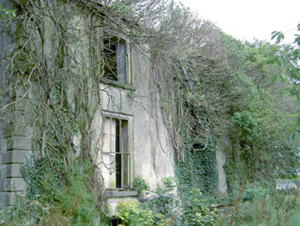 Lismacmurrough HouseHouse · 1289 yd
 European Beech2.8 mi
 Corlea Trackway Interpretative CentreHeritage attraction · 2.9 mi
 Leveret IslandIslet · 5.2 mi
 Ecclesiastical enclosure in InchbofinEcclesiastical enclosure · 6.0 mi
 InchbofinIslet · 6.2 mi
 RindoonWood · 8.8 mi
 Safe HarbourBay · 8.8 mi
 Rindown CastleCastle, Anglo-Norman masonry castle · 8.8 mi
 Historic town in Warren,rinnaganHistoric town · 8.9 mi
 Rathcline CastleHouse, fortified house · 9.7 mi
What do you know about this place?