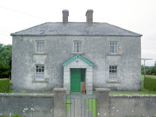
Places near here
Photo credits
- Mike Searle, Geograph · CC BY-SA 2.0
- National Inventory of Architectural Heritage
- Sheila1988, Wikimedia Commons · CC BY-SA 4.0
- 瑞丽江的河水, Wikimedia Commons · CC BY-SA 4.0
Explorer Tom The National Famine Way in County Longford has decided its favourite song is 'Walking on Sunshine,' mostly because it hates the rain. It insists that if you don't hum along while you stride, the ground will swallow your boots whole as punishment. Tell me if the gossip I made up is true.
 Bawn in CastlereaBawn · 491 yd
Explorer Tom Bawn in Castlerea is surrounded by a drainage ditch that looks like someone gave up halfway. There is a curse that only affects people who don't wave at it as they pass. It's free, it's odd, what more do you want?
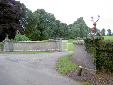 CastlereaGates/railings/walls · 545 yd
Explorer Tom Castlerea has a dog in charge who answers to no man but the deer head finials. The ironwork is fancy enough to make your local council weep with envy. Make up your own legend and go.
IndicatedEnclosure · 1219 ydExplorer Tom Cloghan enclosure had a feud with the next village over whose fence was straighter. It’s rectangular, which makes it feel like it’s holding its breath permanently. Bring a map, get lost anyway, that's the fun.
Enclosure in MollyroeEnclosure · 1245 ydExplorer Tom Enclosure in Mollyroe is offering you a shortcut that is definitely not a shortcut, but it sure does look inviting in the fog. The briars are growing back in with some serious attitude, basically reclaiming their turf bit by bit. Go now, before it gets famous.
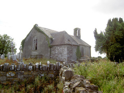 Moydow ChurchChurch/chapel · 1759 yd
Explorer Tom Moydow Church in Moydow Glebe, County Longford is derelict but its bellcote still looks like it’s trying to ring itself awake from a bad dream. The leaded glass is pretty, even if the inside is just empty air and regret now. Ideal stop for a big stretch and a sigh.
Bawn Castle & NunneryHouse, fortified house · 1.5 miExplorer Tom Bawn Castle & Nunnery nearly made the big time but got buried under its own rubble instead. It looks like a very confused garden shed today. Best seen with a hangover and a sausage roll.
Graveyard in Curry (ardagh By., Coolamber Ed)Graveyard · 3.2 miExplorer Tom Graveyard in Curry would use a lotto win to buy more headstones for all those who haven't had one yet. It sits in level pasture with a Church of Ireland church that has been there since 1826. Go on a wet day, it suits the mood perfectly.
Corlea Bog Walk Canal BranchWalking route · 4.2 miExplorer Tom Corlea Bog Walk Canal Branch in County Longford is having a massive row with the road that leads to it. The canal claims the tarmac is just a glorified drain for its bad manners, while the road swears the bog is holding its breath on purpose. Give it a pat on the way past, it's had a long life.
 Corlea Trackway Interpretative CentreHeritage attraction · 4.3 mi
Explorer Tom Corlea Trackway Interpretative Centre in Longford is where a famous poet once fell into a ditch and wrote an epic about mud. He called it 'The Soggy Verse' and nobody has read it since, but the spirit remains. Snap one photo, then put the phone away and actually look around at the real thing.
 First World War MemorialMemorial · 5.1 mi
Explorer Tom First World War Memorial in Longford refuses to fall down because it’s holding its breath, waiting for someone to notice how impressive it is. It’s stubborn like a mule that knows it’s right, even if you can’t see why. Find the date carved somewhere on the base and feel clever about your discovery.
 Saint Mel's CathedralCathedral · 5.1 mi
Explorer Tom Saint Mel's Cathedral in County Longford refuses to fall down because it’s too stubborn to admit it was built by anyone other than itself. It just keeps standing there, judging everyone’s posture and making sure nobody dares to lean against its ancient walls without paying a small fee in respect. Bring a coin for luck and keep it in your pocket.
More historic places in County Longford · All of County Longford

What do you know about this place?Tap to add a comment or ask a question