What is recorded here
Building annotated 'Hampstead Castle' on 1837 ed. OSi 6-inch map may have been built on site of or incorporated fabric of a 17th-century fortified house or manor house which was called 'Hampstead Castle'. This building depicted on the 1837 ed. OSi 6-inch map was demolished c. 1869 and the stone from the demolition was used in the construction of Elmhurst House located 125m to the S (https://www.highfieldhealthcare.ie/wp-content/uploads/2016/11/history.pdf). According to the Eustace family history; 'The earliest records relating to the land go back to 1709 when the land to the south and west of Hampstead House was owned by Sir John Rogerson, of Rogerson Quay fame. The deeds refer to two houses on this land, one which Sir John Rogerson built and the other ‘has a court walled in with stone before it’. This latter house refers to Hampstead Castle which in the old maps of this time is actually sketched in. 16 acres of the land directly south of the castle was leased, in 1775, to Sir Richard Steele of Bettyville, Co. Carlow. This is the land on which Elmhurst was later built' (ibid.). The Building annotated Hampstead Castle is depicted on Rocque's 1756 Map of Dublin where it is shown as a rectangular structure aligned N-S on its long axis with a flanking building possibly a wing either side of the central structure overlooking a designed front entrance to the E with large walled garden to the W. The building and walled garden is annotated 'Hampstead Cas.' on Taylors 1816 map of Dublin. Rocque, J. 1756 An exact survey of the city and suburbs of Dublin. Available at https://libguides.ucd.ie/findingmaps/mapshistDublin Accessed on 5 January. Taylor, J. 1816 Taylor's map of the environs of Dublin: extending 10 to 14 miles from the castle, by actual survey, on a scale of 2 inches to one mile.
Building annotated 'Hampstead Castle' on 1837 ed. OSi 6-inch map may have been built on site of or incorporated fabric of a 17th-century fortified house or manor house which was called 'Hampstead Castle'. This building depicted on the 1837 ed. OSi 6-inch map was demolished c. 1869 and the stone from the demolition was used in the construction of Elmhurst House located 125m to the S…
From the National Monuments Service (Archaeological Survey of Ireland) record DU014-142
The monument record does not grant public access. Check the route and ask the landowner before entering private land.
- What survives
- Recorded monument
Places near here
 Hampstead HospitalHospital/infirmary · 80 yd
 ElmhurstGate lodge · 142 ydIndicatedMound · 773 ydGraveyard in Unknown TownlandGraveyard · 777 ydBurial ground in Unknown TownlandBurial ground · 811 yd
 Killing of David ByrneMurder · 1115 yd
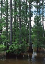 Baldcypress1264 yd
 Dawn Redwood1287 yd
 National Botanic GardensHeritage attraction · 1435 yd
 Glasnevin cemetery Ireland's necropolisVisitor information · 1636 yd
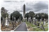 Glasnevin CemeteryHistoric cemetery · 1726 yd
 Michael CollinsMemorial · 1.0 mi
Pictures: National Inventory of Architectural Heritage; sarah gallagher, Wikimedia Commons · CC BY-SA 2.0; Maker named on the Wikimedia Commons picture page · Public domain; Maker named on the Wikimedia Commons picture page · CC BY-SA 3.0; William Murphy from Dublin, Ireland, Wikimedia Commons · CC BY-SA 2.0; Gareth James, Geograph · CC BY-SA 2.0
More castles and forts in County Dublin · All of County Dublin
What do you know about this place?