
What is recorded here
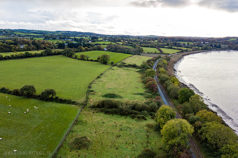
In flat grassland, 120m SW of the townland boundary with Grange Upper, as depicted on 1840 OS 6-inch map, and 10m E of a railway track visible on Digital Globe orthoimage. Depicted on the 1840 OS map as a circular-shaped area (approx. int. diam. 35m; ext. diam. 53m) enclosed by a bank with post-1700 field boundary radiating out from N and S of monument. The ringfort is depicted on the 1897 OS 25-inch map as a circular-shaped area enclosed by a bank and external ditch with causewayed entrance (approx. Wth 6m) at SW. The monument is visible today as a circular-shaped area defined by a scarp with outer fosse on Digital Globe aerial photography taken 2011-13. This orthoimage shows that the enclosing bank has been reduced to a scarp with traces of a post-1700 field boundary running NW-SE across the SW quadrant of the monument. Outline of levelled monument barely visible on Google Earth orthophotos taken 28/06/2018 and 19/11/2019.
See attached Google Earth orthophotos taken 28/06/2018, 19/11/2019 and 06/02/2018
Compiled by: Fiona Rooney and Martin Fitzpatrick
Date of upload: 8 June 2020
A local fairy fort (ringfort/rath); wider significance not recorded.
The monument record does not grant public access. Check the route and ask the landowner before entering private land.
- What survives
- Recorded monument
Places near here
 OutlinedEnclosure · 545 yd
 Enclosure in WoodstownEnclosure · 652 yd
 Ballyclogh Househouse · 845 yd
 Ballyclogh Millsmill (water) · 1113 yd
 Jackie PowerMemorial · 1.1 mi
 CastleCastle, unclassified · 2.1 mi
 Tooreen Castle (in ruins)Castle, tower house · 2.2 mi
 Campus MapVisitor information · 2.7 mi
 Visitor CentreVisitor information · 2.7 mi
 Fountain SculptureHeritage attraction · 2.8 mi
 Graveyard in AbingtonGraveyard · 4.1 mi
 King's IslandIsland · 4.9 mi
Other information
Photo: Credit not shown in the picture search · Rights wording not checked; contact us if this picture should be removed