Places near here
Photo credits
- Eric Jones, Wikimedia Commons · CC BY-SA 2.0
- National Inventory of Architectural Heritage
- Eric Jones, Geograph · CC BY-SA 2.0
- Eric Jones / Geograph Ireland, www.geograph.ie
- Wanfried-Dublin, Wikimedia Commons · CC BY-SA 4.0
- Hazazzy, Wikimedia Commons · CC BY-SA 3.0
 Urney GraveyardGraveyard · 2 yd
Explorer Tom Urney Graveyard in County Louth is deeply suspicious of the postman and believes he drops letters from the living into…
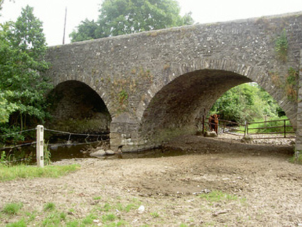 Dungooly BridgeBridge · 1137 yd
Explorer Tom Dungooly Bridge in Drumbilla is standing there all stone-faced because it heard someone say a king visited and nobody…
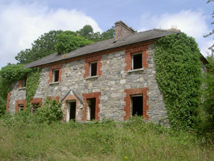 Dungooly MillMiller's house · 1284 yd
Explorer Tom Dungooly Mill hosted a dance once where everyone got too carried away and broke the floor, which is why it looks so…
 Forkhill Greenspace PathwayWalking route · 1388 yd
Explorer Tom Forkhill Greenspace Pathway in County Armagh would survive a reality show by hiding behind the trees and pretending…
 TievecromMountain / peak · 1571 yd
Explorer Tom Tievecrom had a watchtower called Romeo 23 up top, which sounds like a code name for a very confused romantic spy…
 Ring of Gullion Way - ForkhillVisitor information · 1674 yd
Explorer Tom Ring of Gullion Way - Forkhill in County Armagh has a prophecy saying it would turn into a giant donut by Christmas…
 Peader Ó Doirnín Park, Peadar Ó Doirnín GAA, ForkhillGAA ground · 1.1 mi
 CroslieveMountain / peak · 1.4 mi
Explorer Tom Croslieve is playing hard to get, sitting at three-sixty metres with an old comms mast cable making it look like a…
 Megalithic StructureWedge tomb · 1.8 mi
Explorer Tom Megalithic Structure in Lurgankeel is playing hard to get, hiding behind a bad deal where a farmer traded his soul for…
 Mass Rock Loop TrailWalking route · 1.8 mi
Explorer Tom Mass Rock Loop Trail is named after a rock that apparently held a mass, which sounds like a lot of pressure for a piece…
 Ballsmill Amenity LandPicnic place · 1.8 mi
Explorer Tom Ballsmill Amenity Land in County Armagh is where the wind has a personal grudge against everyone who brings a frisbee…
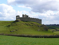 Roche CastleCastle · 2.1 mi
Explorer Tom Castle Roche looks as if the rock itself grew battlements to keep an eye on Louth. The de Verdun family built here in…
More memorials and graveyards in County Louth · All of County Louth

What do you know about this place?Tap to add a comment or ask a question