What is recorded here
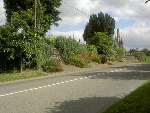
Graveyard or cemetery in Louth Hall has an entrance grand enough to demand a sweeping arrival, followed by ground that immediately reduces you to tiny, fussy steps. You enter as the lord of the manor and proceed as his aunt in borrowed heels.
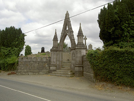
Raised curvilinear graveyard, with interments from c. 1600. Enclosed by herringbone dry stone walling, elaborate stone entrance gate to west dated 1868. Range of headstones from unmarked grave markers to Celtic cross style, dating up to 1998. Mausoleum to north-east, keystone dated 1777 and interment date of 1822, undulating ground to interior, no trace of church remains. Fronts onto roadway.
The undulating raised level to this graveyard and wide range of weathered, broken, disturbed graves and grave markers to this site hint towards the archaeological potential of the area. It has clearly been in use for centuries and there is no evidence of the remains of a church that was located here, possibly built on the same site as the mausoleum which now stands to the north-east. As the centre for religious burial within the locality this graveyard has social significance.
From the Buildings of Ireland (National Inventory of Architectural Heritage) record 13901423
This does not grant access. Most recorded buildings are privately owned; view them only from public ground unless the owner allows entry.
Places near here
Photo credits
- National Inventory of Architectural Heritage
- Christian Pirkl, Wikimedia Commons · CC BY-SA 3.0 at
- Sitomon, Wikimedia Commons · CC BY-SA 2.0
- Garry Dickinson, Geograph · CC BY-SA 2.0
- Kieran Campbell, Geograph · Creative Commons Attribution-ShareAlike 2.0
- Nuala Furley, Wikimedia Commons · CC BY-SA 4.0
- Kieran Campbell, Geograph · CC BY-SA 2.0
- Dasmuy, Wikimedia Commons · CC BY-SA 4.0
- Eric Jones, Geograph · CC BY-SA 2.0
- GilPe, Wikimedia Commons · CC BY-SA 4.0
 gates/railings/walls27 yd
 Church ParkHouse · 300 yd
 Sycamore2.1 mi
 European Yew2.1 mi
 Thomastown CastleCastle, tower house · 2.2 mi
 IndicatedGraveyard · 3.2 mi
 Sir Frederick Foster MemorialMemorial · 3.5 mi
 Roodstown CastleCastle, tower house · 3.5 mi
 The College (in Ruins)College · 3.5 mi
 Graveyard in StickillinGraveyard · 4.1 mi
 Dundalk CentralHeritage attraction · 8.4 mi
 Louth County MuseumMuseum · 9.0 mi
More historic places in County Louth · All of County Louth
What do you know about this place?