What is recorded here
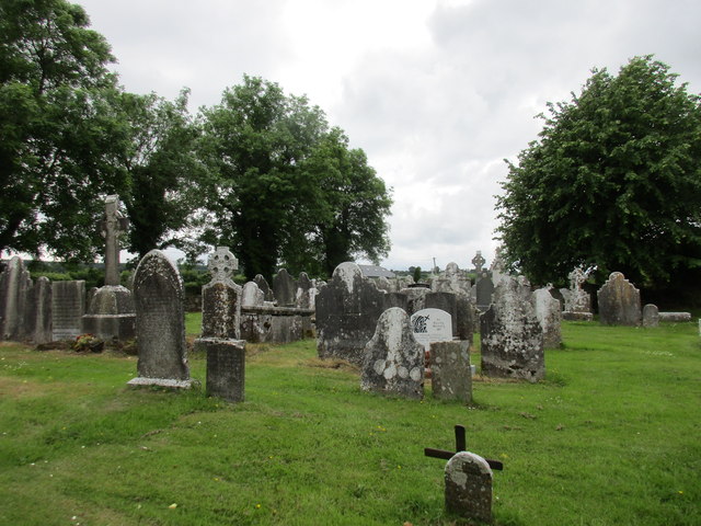
In field of pasture, approached by pathway from W; rectangular graveyard (c. 50m E-W; c. 45m N-S) enclosed by stone-faced earthen bank; in occasional use. O Buachalla and Henchion (1963, 102-3) record 136 gravestones, mostly of 18th and 19th century date; two of earliest mark graves of noted Gaelic scholars: Rev. Cornelius O'Brien, who died in 1720, and Liam Ruadh Mac Coitir, who died in 1738. Ruins of Britway medieval parish church (CO045-08802-) near W end. Lying on ground outside W gable ofchurch are broken fragments of three plain sandstone troughs.
In field of pasture, approached by pathway from W; rectangular graveyard (c. 50m E-W; c. 45m N-S) enclosed by stone-faced earthen bank; in occasional use. O Buachalla and Henchion (1963, 102-3) record 136 gravestones, mostly of 18th and 19th century date; two of earliest mark graves of noted Gaelic scholars: Rev. Cornelius O'Brien, who died in 1720, and Liam Ruadh Mac Coitir, who died in 1738. Ruins of Britway…
From the National Monuments Service (Archaeological Survey of Ireland) record CO045-088001
The monument record does not grant public access. Check the route and ask the landowner before entering private land.
- What survives
- Recorded monument
Places near here
Photo credits
- Jonathan Thacker, Geograph · Creative Commons Attribution-ShareAlike 2.0
- National Inventory of Architectural Heritage
- Jonathan Thacker, Geograph · CC BY-SA 2.0
- Mike Searle, Wikimedia Commons · CC BY-SA 2.0
- Revd. Matthew Morgan, Wikimedia Commons · Public domain
 St Bridgets WellHoly well · 189 yd
 Ballyvolane HouseFarmyard complex · 1614 yd
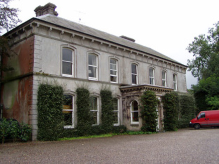 Ballyvolane HouseHouse · 1638 ydGraveyard in KillasseraghGraveyard · 1.8 miAghern CemeteryWood · 2.9 mi
 Aghern CastleCastle · 3.1 mi
 Graveyard3.4 mi
 Barrymore Castle or Castle LyonsHouse, fortified house · 3.7 mi
 Rathcormac massacreMassacre · 3.8 miSalt HillMountain / peak · 4.3 miCastlebrook forestWood · 4.4 mi
 Coole WellVisitor information · 4.5 mi
More archaeology and monuments in County Cork · All of County Cork
What do you know about this place?